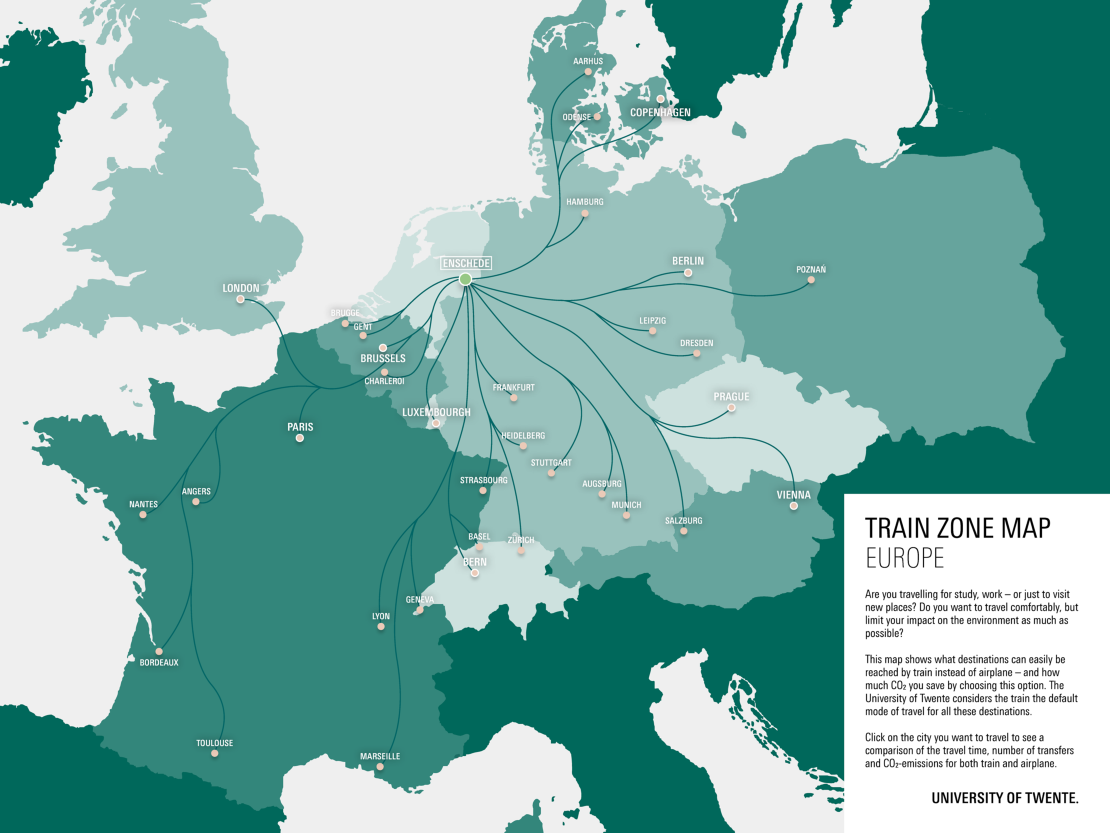
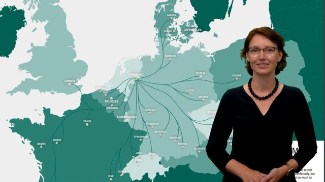
The University of Twente wants to reduce the CO2 emissions caused by air travel. That is why the UT introduces the Train Zone Map: a map of destinations which makes it easy to compare travel by train and plane. Not only the CO2 emissions, but also the total travel time and the number of transfers can be compared. With the tool, the UT wants to encourage its staff and students to choose the train over the plane whenever possible. ’For short distances, the train is the norm'.
Click the image to open the Train zone map
Traveling again
In 2019, the last pre-corona year, air travel was the cause of about 13% of the total carbon footprint of the University of Twente. In 2020 and 2021 the number of international trips dropped to almost zero, but now that travel is possible again more staff and students are going abroad. ‘It's great that the restrictions have been lifted,' says Machteld Roos, Vice-Chairman of the Executive Board. ‘International cooperation is essential in science, and meeting each other physically is irreplaceable. At the same time, it is clear that we have to lower our emissions as much as possible. We have discovered the possibilities and advantages of online meetings. Therefore, when planning international meetings, we can all think carefully beforehand whether a trip is really necessary, or if a digital meeting could suffice. In this way, we can significantly reduce our CO2 emissions. If it turns out a physical meeting is neccesary, the next question is which means of transport is most suited for the trip. Besides CO2 emissions, travel comfort and travel time are also important factors in this decision. The Train zone map clearly shows for which destinations the train is an excellent choice.’
Advantages
Travelling by train causes far less CO2 to be emitted than travelling by plane: for example, on a journey from Enschede to London the difference is more than 80%. But the train offers more advantages than just lower emissions. Although the trip often takes longer than by plane, the difference is smaller than it may seem. This is because travel time to and from the airport, including at the destination, must be included. You also have to arrive at the airport well in advance, and waiting times at security and the baggage belt can be considerable. ‘When travelling by train, these concerns are far less of an issue, or sometimes not at all. This means that you can sit and relax for a much larger portion of your total trip. Time you can use to work, read a book or just to look at the passing landscape’ says Roos. ‘Moreover, the seats are more comfortable and you can stretch your legs when you want to. All in all, it's often a lot more relaxing than the plane, I've noticed.’
BOOKING A trip
The information on the Train Zone Map is only an indication of which cities are easy to travel to by train: of course other cities can also be reached by train. In addition, in practice every journey is different, as departure and transfer times may vary. Information about booking a train journey can be found on the business travel page in the service portal.
In addition to the current Train zone map, the UT is working on a dynamic version of the map with more functions and more cities. That map will include information for cities that are more difficult to reach by train - for the more adventurous train traveler. Also, in that version the car (combustion engine and electric) will be included as an option in the comparison in order to give a more complete picture.
Strategic priority
Sustainability is a strategic priority for the UT. Roos: 'With the Train zone map, we're putting that into practice. By choosing the train as standard for journeys below 800 kilometres, we reduce our CO2 emissions and contribute to a more sustainable society.
Feedback
Do you have questions or feedback about the Train zone map? We would like to hear from you, so that we can continue to improve the map. Please send an email to sustainability@utwente.nl.


