Shape a more sustainable world with geospatial technologies
Join us for an exciting and insightful afternoon exploring how cutting-edge geospatial technologies like GIS (Geographic Information Systems) and Remote Sensing shape a more sustainable world. Whether you're curious about maps, satellite imagery, or how these tools help address real-world problems like climate change, urban planning, and disaster response — this workshop is the perfect place to start!
| 01:30 - 02:00 | Registration formalities and coffee |
| 02:00 - 02:20 | Session 1: GI Science for Newbies!
|
| 02:20 - 02:40 | Session 2: Introduction to Remote Sensing and its Societal Applications
|
| 02:40 - 03:00 | Coffee Break and Split to Workshop Rooms |
| 03:00 - 04:00 | Session 3: Parallel Hands-On Workshops Workshop 1: Modelling Energy Transition solutions – Biomass and Solar/Wind Energy in the DISC Lab using in-house tools for Geospatial Modelling developed by ITC. Prerequisites: None! Everyone is welcome – from amateurs to GIS experts! Workshop 2: Change Detection for Deforestation in the Amazon Rainforest with Google Earth Engine (GEE) and QGIS, an open-source software. Participants get hands-on experience working with the GEE Data Catalogue and performing Spatial Data Processing with QGIS. Prerequisites: None! Everyone is welcome – from amateurs to GIS experts! |
| 04:20 - 05:00 | Session 4: Wrap-Up & Green Hub Fun Activity – "Green Washing" We'll end the day with a fun, team-based activity called "Green Washing" by the Green Hub of UT, where participants put their sustainability knowledge to the test. There might even be prizes for the winning team! |
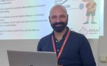 In this engaging talk,
  Dr Thomas Groen


