By making smart use of spatial data during the development of new policy, Ethiopia can tackle its societal problems it faces such as food security, water management, and climate change more effectively. However, this requires a reinforcement of the knowledge network. For this purpose, the Faculty of Geo-Information Science and Earth Observation (ITC) at the University of Twente will collaborate on that with the Ethiopian partners in the next few years.
The ITC has recently signed an agreement with the Ethiopian Minister of Education and the Universities of Bahir Dar, Addis Ababa, and Mekelle. This four-year programme is primarily being funded by Nuffic's Innovative Capacity Building programme, with the Ethiopian Ministry of Education and ITC also making a contribution. The programme is in line with the Ethiopian government's Growth and Transformation Plan (GTP) and the Dutch Embassy in Ethiopia's Multi-Annual Strategic Plan.
EENSAT
As part of the Ethiopian Education Network to Support Agricultural Transformation (EENSAT) programme, initiatives have been set up to help this African nation to optimally capitalize on geoinformation and geoinformation technology. Teaching and research projects have been organized and initiatives to boost cooperation between the public and private sectors have also been put into action.
One of these projects, involving Ethiopia's three universities and the Technical Vocational Education and Training institutes (TVET’s), seeks to improve the country's educational curriculum.
Local social challenges
The themes of food security, water management, and climate change were selected, as they are extremely complex and closely related issues that constitute major modern-day challenges for Ethiopia. The use of spatial data can make an important contribution to the resolution of these issues. These topics serve as the primary point of departure for the activities within the network, but attention is also paid to other relevant matters such as spatial issues with regard to land ownership and risk management in the field of disaster relief.

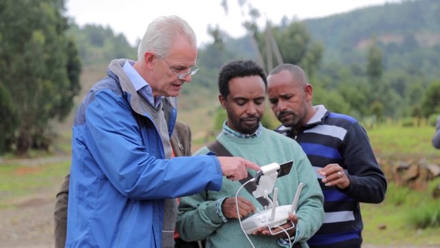
The goal of the programme is to boost Ethiopia's ability to capitalize on spatial data when planning and monitoring local and regional development. This is done by incorporating technology such as GIS and earth observation and more innovative applications using UAVs (unmanned aerial vehicles or drones), mobile technology, and crowdsourcing.
Broad collaboration
This programme not only brings together the universities and TVET institutes, but also builds a bridge between the public and private sectors. This helps ensure that education and training programmes are optimally coordinated with the needs of the job market and innovation in the professional field. The wheels were put in motion during the programme's kick-off in Addis Ababa on 5 October 2017. Various stakeholders from a wide range of sectors attended the official kick-off, particularly to discuss and give advice on the EENSAT programme.
For more information about the programme, you can visit the website (www.eensat.org), or contact the EENSAT team via contact@eensat.org.


