ITC PhD researcher, Milad Mahour, from ITC's department of Earth Observation Science, received the best student paper award at the Image and Signal Processing for Remote Sensing of SPIE's Remote Sensing and Security+Defence International Symposia held 24-29 September 2016 in Edinburgh, United Kingdom.
As a committed supporter of excellence in student research, SPIE supports Best Student Paper Awards at SPIE conferences across the globe. This award is designed to encourage and acknowledge excellence in student paper presentations. A panel of experts evaluate the papers, both for quality and content.
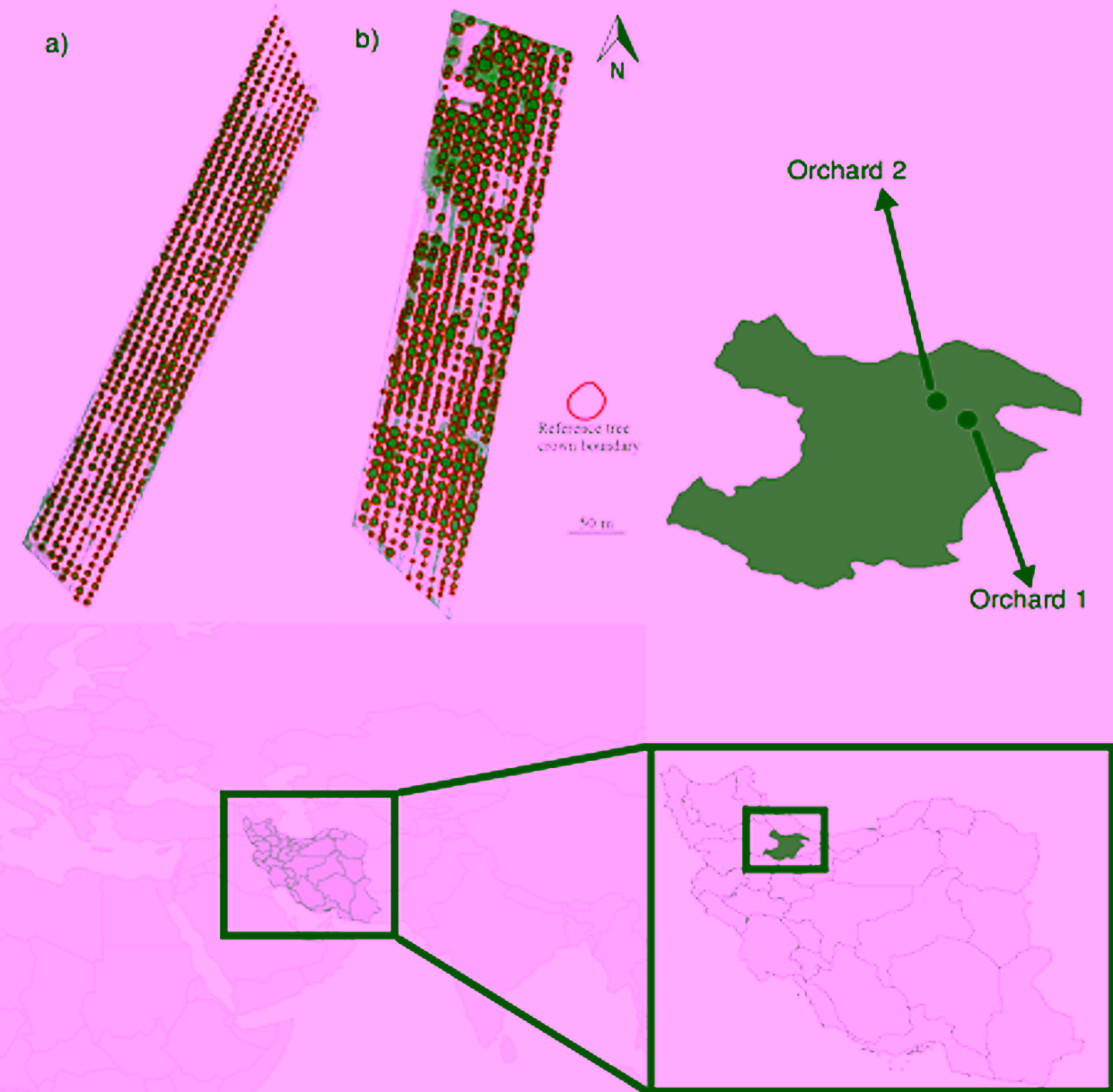
The paper titled “Tree detection in orchards from VHR satellite images using scale-space theory” was co-authored by faculty ITC staff researchers Prof. Alfred Stein and Dr. Valentyn Tolpekin. The paper shows how detailed, reliable information is extracted from Very High Resolution (VHR) satellite images to detect individual trees. The application concerns two orchards in the Ghazvin area in Iran, where the trees differed in type (one orchard was planted with peach trees, the other with walnuts), size and planting patterns. It is one of the oldest agricultural areas in the world. The trees extracted from the images agreed well with reference data: the locations of the centroids corresponded well with the locations on the ground, and only a few trees were missed. The study demonstrated how image segmentation can excellently be done for orchards with different types of trees. As a consequence, such tree detection can be very useful if it is combined with irrigation management based on Remote Sensing. The flexibility of modeling as shown in this study allows scientists, farmers and decision makers to apply it to other VHR images from different platforms for further studies. Examples are the monitoring of trees, change detection, mapping tree health and also crop water requirement.


