A groundbreaking ESA-funded project led by ITC Faculty in collaboration with the Forschungszentrum Jülich is revolutionizing the way we assess crop conditions with AI, integrating satellite imagery with field photos to generate comprehensive agricultural reference data.
As extreme weather events and climate change place increasing pressure on global food production, timely and accurate information on crop status is more critical than ever.
To address this, AgroVision, a project funded by the European Space Agency (ESA), aims to deploy innovative Geo-Foundation Models to provide rich, real-time insights into agricultural conditions.
ITC Assistant Professor and Project Investigator (PI) of AgroVision, Claudia Paris, explained, “I was able to write this proposal thanks to the starter grant I got in 2023. The money I received was used to hire a PHD student, Adel Abbas, working on the integration of satellite data and field photos to improve decision-making processes and optimize agricultural practices. Collaborating closely with Adel and exchanging ideas during our brainstorming sessions played a key role in shaping this research idea.”
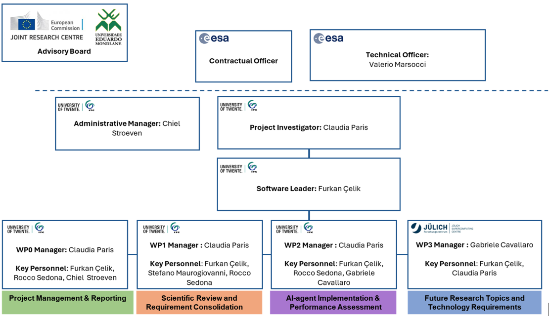
Working packages and staff involved in Agrovision
Transforming field photos to actionable information
Food producers need more than just crop maps. They require real-time agricultural monitoring systems that can evaluate how extreme weather affects crop productivity, detect different growth stages, and identify problems in the fields.
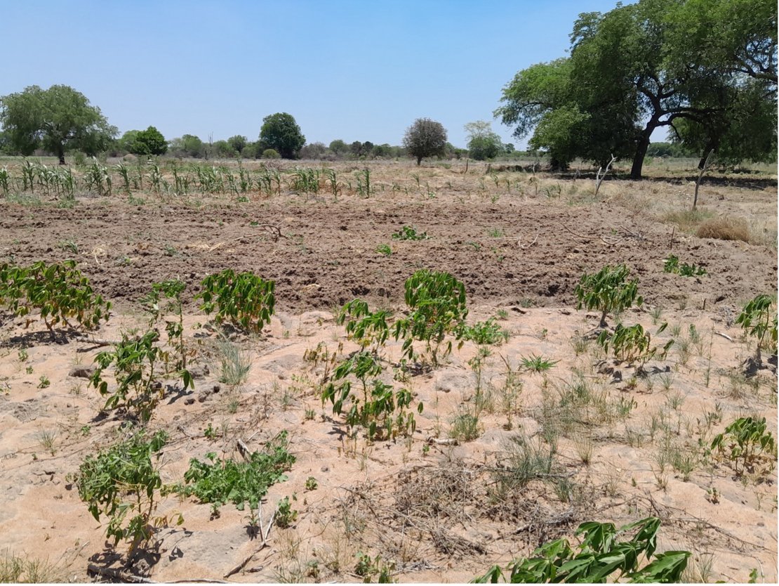
Photo by Statistics from Space project
Geo-tagged time-stamped field photos might be the solution to this challenge. Every time a field photo is collected on the ground, it can be matched with satellite images time series (SITS) from the same location. Unlike traditional field surveys that rely on manual notes, combining satellite images with field photos provides a complete picture of what's happening in agricultural areas. This combination can reveal details about crop health (such as damage from drought, floods, or pests), growth stages (like flowering or fruiting), and farming techniques (such as growing multiple crops together).
The AgroVision project aims to advance this technology by creating a ready-to-use dataset of geo-tagged time-stamped field photos matched with time series of satellite images collected across Europe, and depoying innovative Deep Learning Geo-Foundation Models that effectively integrate satellite data and field photos.
From farmers to policymakers
By merging satellite data and field photos, AgroVision’s Models could offer early warning tools to detect reductions in crop productivity, enabling farmers and policymakers to make data-driven decisions on interventions, such as assessing flood damage or identifying crops at vulnerable growth stages.
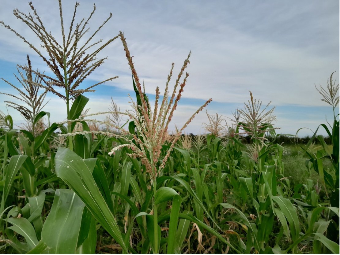
Photo by Statistics from Space project
Additionally, the project aims to reduce the logistical and financial burden of traditional field data collection, especially in low-income regions. The goal is that after eliminating the need for manual annotation and relying solely on field photo collection, high-quality agricultural monitoring becomes more accessible worldwide.
As a first case study, the Centre of Study of Politics and Agroalimentary Programmes of Mozambique (CEPPAG) plans to deploy AgroVision in the country on the field data collected during their 2025 field survey as part of the StatisticFromSpace project. Due to the complexity of the study area, characterized by smallholder farming, intercropping practices, and agroforestry systems, the field data protocol already includes capturing five landscape photos (from the actual point and the four cardinal directions), close-up images, as well as standard manual crop status annotations.
Current fieldwork protocols typically rely on labor-intensive manual annotations, which are especially challenging in low-income and developing countries where agricultural reference data is scarce or non-existent. AgroVision can help address this gap by accelerating field data collection and significantly reducing the reliance on manual annotations, offering a more efficient alternative to traditional methods.
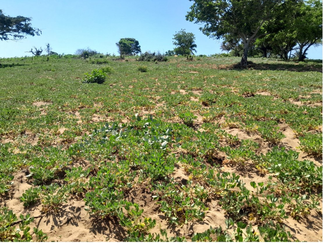
Photo by Statistics from Space project
More information
AgroVision, led by the Faculty of Geo-Information Science and Earth Observation (ITC), will be developed in collaboration with the Simulation and Data Lab for AI and Machine Learning for Remote Sensing at the Jülich Supercomputing Centre (Forschungszentrum Jülich).
These institutions offer complementary expertise: ITC specializes in the scientific aspects of applying DL models to map and monitor agricultural areas using EO data and field photos, while FZJ focuses on implementing and developing scalable Geo-FM solutions. Divided into 3 Working Packages, AgroVision had its kick-off on May 20th and will run for 18 months.


