In their research, associate professor from the NRS Department Tiejun Wang and his master’s student Zijing Wu developed an AI-model to automatically locate and count large herds of migratory ungulates (wildebeest and zebra) from space. In collaboration with international experts from U.K., U.S. and Kenya, ITC researchers used their method in the Serengeti-Mara ecosystem using fine-resolution (38-50 cm) satellite imagery. They achieved accurate detection of nearly 500,000 individuals across thousands of square kilometres and multiple habitat types. The scientists at the Department of Natural Resources (ITC Faculty - University of Twente) recently published their results in the scientific journal Nature Communications.
The Great Wildebeest Migration is the largest terrestrial mammal migration on our planet. It drives multiple ecological processes that support the health of humans and wildlife across the region. However, due to climate and land cover/use change, this natural process is becoming compromised. Developing accurate, cost-effective monitoring methods has quickly become a vital necessity to protect wildebeests and the ecosystem. To address this issue, Tiejun Wang demonstrates, for the first time, the capability of satellite remote sensing and machine learning techniques to automatically and accurately count very large populations of wildebeest and zebras. Even across the highly heterogeneous landscape of their migration journey.
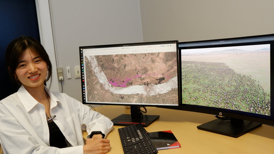 MSc Zijing Wu, first author of the paper
“We are currently in the first year of implementing the post-2020 global biodiversity framework, which the UN adopted at the 15th Conference of Parties to the UN Convention on Biological Diversity. The UN also recently established the Global Sustainability Development Goals as well as the first round of risk assessments on biodiversity and ecosystem services through the Intergovernmental Platform on Biodiversity and Ecosystem Services” explains Tiejun.

AI + Satellite remote sensing
New satellite remote sensing and machine learning techniques make it possible to monitor global biodiversity with speed and precision. These efficiencies promise to reveal novel ecological insights at spatial scales which are germane to the management of populations and entire ecosystems. Tiejun Wang’s research demonstrates, for the first time, the capability of satellite remote sensing and machine learning techniques to automatically and accurately count very large populations of terrestrial mammals across a highly heterogeneous landscape.
Approximately 120.000 individual wildebeests are accurately detected by the algorithm in this large area. Each purple dot is one wildebeest.
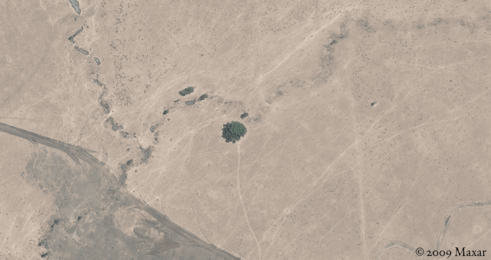
Wildebeests are caught avoiding a tree, presumably due to the presence of lions under its shadow. |
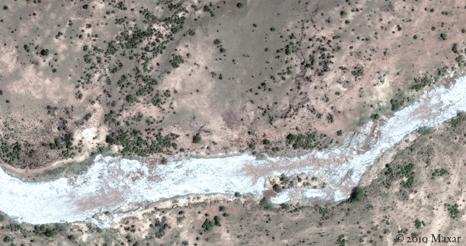
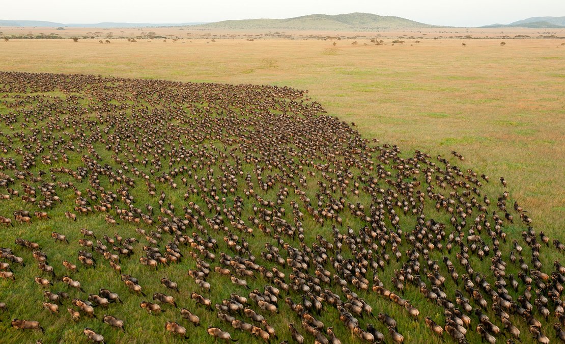
The wildebeest are massing along the bank of the Mara River ahead of crossing. |
Counting wildebeest from space
This study yielded highly accurate results and the largest training dataset ever published from a satellite-based wildlife survey (53,906 annotations). Beyond providing a truly open-source and transferable method for satellite-based wildlife surveys, the approach is spatially scalable for the first-ever total counts of migratory ungulates in open landscapes. Observing expansive herds of migratory ungulates from space presents an entirely novel perspective for the study of the ecology of animal aggregations.
More information
Dr Tiejun Wang is an associate professor of Remote Sensing and Geospatial Ecology in the department of Natural Resources (Faculty of ITC, University of Twente). His publication, entitled ‘Deep learning enables satellite-based monitoring of large populations of terrestrial mammals across heterogeneous landscape’, has been published in the scientific journal Nature Communications. This paper is a result of an international collaboration with experts from Kenya, the U.S. (i.e., Smithsonian Conservation Biology Institute, Princeton University, University of California, The National Academies of Sciences and U.S. Army Research Laboratory) and the U.K. (i.e., Lancaster University, University of Kent, University of Glasgow, and the University of Southampton). It is open access and can be read online.


