Retrieval of soil physical properties: Field investigations, microwave remote sensing and data assimilation
Due to the COVID-19 crisis the PhD defence of Hong Zhao will take place online.
The PhD defence can be followed by a live stream.
Hong Zhao is a PhD student in the department of Water Resources (WRS). Her supervisor is prof.dr. Z. Su from the Faculty of Geo-Information Science and Earth Observation (ITC).
 As the lower boundary condition of the atmosphere, soil moisture plays an important role in land and atmosphere interactions and thereby in weather/climate predictions. Basic soil properties (i.e., soil texture and organic matter content) and associated soil hydraulic properties (SHPs) (i.e., soil water retention curve and hydraulic conductivity) and soil thermal properties (STPs) (i.e., soil heat capacity and thermal conductivity) are essential in estimating soil moisture-temperature profiles with land surface models (LSMs). Due to a lack of detailed soil property maps, the soil parameterization schemes considered in LSMs may be unrepresentative and hence introduce uncertainties in land surface states and heat fluxes estimates. With the use of the physical link between soil physical properties, soil moisture and temperature and the soil dielectric constant, soil physical properties can be retrieved with a LSM coupled with a microwave emission observation model in a data assimilation (DA) framework.
Passive L-band microwave remote sensing has become the most promising technique for the retrieval of near-surface soil moisture based on the measured brightness temperature (, =H, V). This trend has been further accelerated by the launch of two innovative space missions equipped with L-band radiometers, the Soil Moisture and Ocean Salinity (SMOS) and the Soil Moisture Active and Passive (SMAP) missions, which have provided global and soil moisture products at nearly daily scales. The retrieval of soil physical properties by assimilating observations into a coupled LSM and L-band emission model can thus be regarded, especially in remote areas, as a soil monitoring system utilizing space-based Earth observation (EO) data with in situ data and modeling.
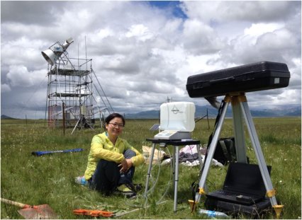
This research aims to improve our understanding of soil physical property retrieval by using the aforementioned DA system. The LSM as a system model and emission model as an observation operator are the two main components involved. In LSMs, soil moisture-temperature estimates are primarily determined according to basic soil properties and associated SHPs & STPs. In microwave L-band emission modeling, the surface roughness imposes significant impacts, especially on H polarization emission, and the resulting uncertainties in emission will propagate into the soil physical property retrieval process. Therefore, before carrying out the retrieval of soil properties, this thesis first focuses on soil physical properties for LSM modeling (Chapter 2) and the effect of surface roughness on L-band estimates (Chapter 3). The Maqu site (33.91°N, 102.16°E) on the eastern Tibetan Plateau (TP), which provides comprehensive field observations, is chosen as the study area to help conduct the investigation.
To validate the retrieved results and analyze basic soil properties and SHPs & STPs for accurate land surface modeling on the TP, we conducted in situ and laboratory measurements of soil physical property profiles across different climate zones of the TP. With these collected profiles pertaining to the arid (Ngari), semi-arid (Naqu) and sub-humid (Maqu) zones, we compiled the Tibet-Obs soil property dataset. Based on this dataset, in Chapter 2, we 1) analyzed the variations in basic soil properties and SHP & STP across these three climate zones; 2) examined various schemes for estimation of the porosity and SHPs & STPs on the TP; 3) quantified the uncertainties in existing soil basic property datasets and their derived SHPs & STPs on the TP. We found that 1) the basic soil properties and SHPs & STPs differed in each climate zone and varied along the soil profile; 2) the Cosby et al. (1984) pedotransfer functions (PTFs) proved more applicable for SHP estimation with the Clapp and Hornberger (1978) (CH) model, and the continuous Wösten et al. (1999) PTFs with the van Genuchten (1980) - Mualem (1976) (VG) model. The De Vries (1963) semi-empirical model proved superior in the estimation of soil thermal properties. 3) We recommend the SoilGrids1km dataset in the arid and sub-humid zones, and a combination of FAO-UNESCO in the shallow layers and HWSD in the deeper layers of the semi-arid zone is recommended on the TP.
We have published this dataset at the 4TU.Centre for Research Data (https://data.4tu.nl/articles/Soil_Hydraulic_and_Thermal_Properties_for_Land_Surface_Modeling_over_the_Tibetan_Plateau_version_1_/12721418/2). We hope that the compiled dataset and our findings contribute to modeling and research of the Third Pole environment in the hydro-climatology community, and fill geographic gaps amidst the already published global soil databases by the soil community.
To account for the effect of topsoil structures and an inhomogeneous moisture distribution in the soil volume on L-band radiation, we developed an air-to-soil transition (ATS) model with a newly proposed dielectric roughness parameterization scheme in Chapter 3. The Tor Vergata discrete scattering model (TVG) integrated with the advanced integral equation model (AIEM) was adopted as the baseline model configuration to simulate the L-band brightness temperature (, =H, V). Then, the ATS model was coupled with the foregoing model to assess its performance. The comparison results indicate that the ATS model was necessary, as it compensated for the underestimation of (≈ 20-50 K) in the baseline simulations. The proposed dielectric roughness is suggested as a replacement of the fixed roughness parameter currently considered in state-of-the-art SMAP and SMOS soil moisture retrieval methods, as it captures the dynamics of surface roughness related to hydro-meteorological conditions. However, the discrepancy between the modeled and observed values during the soil freeze-thaw transition period suggests that the ATS model still requires improvement by also incorporating the effects of surface temperature, surface water fraction and liquid water-ice mixtures in the calculation of the dielectric roughness thickness.
In Chapter 4, we coupled the enhanced physically-based discrete scattering-emission model, namely, the ATS+AIEM+TVG model (Chapter 3) with the community land model (CLM) v4.5 to retrieve soil physical properties by using the local ensemble transform Kalman filter (LETKF) algorithm assimilating SMAP Level-1C (L1C) and data separately. To identify whether the retrieved soil properties alone were sufficient to improve estimates of soil moisture and thereby land heat fluxes with the CLM, we conducted two comparative DA experiments. One experiment updated only the soil properties (Only_Para), and the other experiment updated both the soil properties and soil moisture (Joint_Updt). The results revealed an improvement of the estimates of the soil properties of the topmost layer by assimilating SMAP ( H, V), as well as of the profile using the retrieved top-layer soil properties and prior depth ratio. In the Only_Para experiment, the use of was very sensitive to the retrieval of the clay fraction and organic matter, whereas was sensitive to sand fraction retrieval. In contrast, the Joint_Updt experiment could retrieve both the sand and clay fractions when assimilating either or . The Joint_Updt experiment provided better estimates of soil moisture, soil temperature and land heat fluxes during the assimilation period than those provided by the Only_Para experiment. However, we found that the obtained (retrieved) soil properties with a fine accuracy were not sensitive factors in this case, which could lead to an improvement in soil moisture estimates. In future studies, we shall therefore consider the uncertainties in CLM model structures, such as the fixed PTF structures, the hydraulic function describing the soil water retention curve, the water stress function determining root water uptake and the soil layering structure, as well as the parameterizations describing land heat fluxes.
As a final note, we would like to highlight that the DA system for soil property retrieval developed in this study has the potential to obtain regional and even global soil parameter sets consistent not only in physics but also at the different scales. Moreover, we should further investigate the uncertainties in LSM and L-band radiometry modeling, as this may improve not only the retrieval of soil properties but also the estimation of land surface states/fluxes.


