A team of UT researchers from the Faculties of ITC, BMS and ET has recently published a new study published in the International Journal of Applied Earth Observation and Geoinformation that found using digital twins can improve planning and coordination in cities. Digital twins are digital representations of physical objects or systems, and have been widely used in manufacturing, construction, and maintenance to improve planning and coordination. Now, researchers are exploring how they can be adapted to serve cities and their complex, dynamic ecosystems.
ITC researcher and the study's lead author, Dr Ville Lehtola said: "Digital twins have the potential to bring significant benefits to cities, by allowing city officials, residents, and businesses to access up-to-date information on the city's infrastructure and services." The researchers believe that their findings could significantly improve the efficiency of planning and managing cities. By using digital twins, cities can save time and money, and ultimately make our urban environments more sustainable.
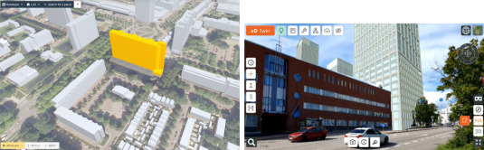
Broad concept
In their publication, the authors discussed the technical challenges and open questions surrounding the realization and benefits of urban digital twins. “There are many different types of digital twins, each with its own technical characteristics and applications, so it can be challenging to integrate them into a single, comprehensive urban digital twin”. For example, the creation of a digital twin for manufacturing and construction starts with the digital twin and ends with a physical product. Meanwhile, creating digital twins for maintenance or smart city management purposes require constant changes and updates.
A complete back-end
For these constant updates, the researchers suggest the development of a back-end digital twin infrastructure to contain all information. “This means more than just a 3D model of all the buildings. The digital twin should for example also have information about traffic noise, solar radiation, and road safety”, explains Lehtola. The back end could then be used to create different front-end representations for different users. For example, a VR world of a city that its citizens can explore. Lehtola: “A city planner needs different data from the digital twin compared to citizens for example. However, both can profit from such a system.”
More information
This research was conducted in collaboration between several UT researchers and Forum Virium Helsinki. Involved authors were Dr Ville Lehtola, Dr Mila Koeva, Dr Ir Sander Oude Elberink, Dr Paulo Raposo (all Faculty of ITC), Juho-Pekka Virtanen (Forum Virium Helsinki), Dr Ir Faridaddin Vahdatikhaki (Faculty of ET) and Dr Simone Borsci (Faculty of BMS).
Their review paper, ‘Digital twin of a city: Review of technology serving city needs’, was recently published in the scientific journal International Journal of Applied Earth Observation and Geoinformation. The paper is open-access and available online.


