Current projects
- ProjectFacultyThemesProject managerPeriod
EENSAT
The EENSAT program is a network cooperation program between three Ethiopian universities (The African Centre for Disaster Risk Management of Addis Ababa University, Bahir Dar University and Mekelle University) and ITC. The cooperation is centered around support to the agricultural transformation agenda of the Ethiopian Government making use of geographic information management and earth observation. The project activities will lead to the development of teaching, research and operational capacity at different levels of the National Qualifications Framework of Ethiopia. It focuses on the use of GIS, remote sensing and on applications such as sustainable agriculture, food security, climate change, natural hazards and disaster risk management, and water resources management. The EENSAT program pays specific attention to the linkages with the private sector
The EENSAT program is a joint initiative by ITC, NUFFIC and the Government of Ethiopia and the participating universities in Ethiopia and is carried out in the framework of the innovation agenda of the NICHE program.
SALTISolutions
Salt intrusion through urbanising deltas: Solutions
Sea level rise, drought, subsidence, and dredging of waterways can exacerbate the intrusion of seawater in deltas and estuaries, with repercussions for, for example, nature and drinking water supply. The large NWO-Perspectief funded research programme SALTISolutions (led by TU Delft) aims to gain insight in the mechanisms of salt water intrusion, and investigates potential measures to mitigate the effects of salinity intrusion, including nature-based solutions. The programme aims to develop a digital twin of a delta, to test new solutions related to salinity intrusion based on research, and in interaction with stakeholders.
In our PhD subproject as part of SALTISolutions (i.e., WP7.2: Implications of nature-based SALTISolutions for estuarine ecosystem engineering), we study the potential effects of such nature-based solutions on estuarine services, such as habitat provision and safety from flooding, on top of the ability of these measures to mitigate salinity intrusion. We focus our work on understanding solutions involving ecosystem engineers, i.e. organisms (such as saltmarsh plants and oysters) that have the ability to modify their physical environment. We take a combined approach of hydrodynamical modelling and remote sensing.
This subproject is a collaboration between the Faculty of Engineering Technology, group Marine and Fluvial Systems (Prof.dr. S. Hulscher and dr.ir. B. Borsje) and the Faculty of Geo-Information Science and Earth Observation (ITC), Dept Water Resources (Prof.dr. D. van der Wal) of the University of Twente.
Please see for more information on the SALTISolutions research programme and involved research institutes and stakeholders: SALTISolutions | NWO
Rewarded! - KNAW Pilot Fund Science Communication
Region: Worldwide
Description: Science communication is a crucial tool for achieving positive societal impact. How can science communication become an integral part of our tasks as academics? How can Early Career Researchers learn how to do science communication in a meaningful way? How can we measure the impact of our science communication? The aim of the Gewaardeerd!(Rewarded!) project was to stimulate experienced science communicators, facilitate new initiatives, and gather insights for a national guidelines in effective science communication. Wieteke Willemen, together with ITC colleagues Arjan Dijkstra and Frank van Ruitenbeek teamed up to give science communication for global sustainability issues a boost.
The Rewarded! Guideline was published on 31 October 2022, helps knowledge institutions to recognize and reward scientists who are structurally involved in science communication and public engagement activities. The Science Communication by Scientists: Rewarded! pilot fund and enrichment programme has been made possible by the Ministry of Education, Culture and Science and was carried out by a project group within Royal Netherlands Academy of Arts and Sciences (KNAW), under the guidance of the Rewarded! Advisory Board.
Sponsor: KNAW Pilot Fund Science CommunicationHarmony Explorer
The idea behind new Explorer Mission of the European Space Agency, Harmony, is to use two passive micro-satellites (Concordia and Discordia) flying in formations (cross and along-track) with a Sentinel-1D (S1D). This constellation, of two passive receivers and a conventional Synthetic Aperture Radar (SAR), will provide interferometric SAR capabilities. The scientific objectives of SAR observations of Harmony relate, primarily, to the characterisation of dynamic processes above and of ocean surfaces.
ITC is examining the feasibility of expanding Harmony’s capabilities to include TIR for water quality applications. So far, the ITC team has been able to infer the surface dynamics from the temperature gradient and has established the observational evidence of temperature effects on the wind field. The application of this finding comes in handy in a changing climate where the rising global temperature is leading to more extreme weather events.
The figure below shows SAR observation obtained from Sentinel-1 C band of the Agulhas current (right upper panel) collocated with the gradient of sea surface temperature derived from the Sentinel-3-SLTSR (upper right panel). The lower panels show the vorticity and divergence of sea surface current estimated from the wind field and the gradient of sea surface temperature.
Collocated S1-SAR (acquired at 17:00) and S3-SLTSR (acquired at 20:44) of the Agulhas, 23 July 2020.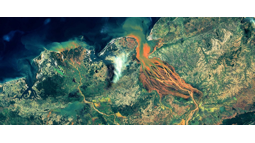
ESA EO Africa
The objective of this initiative is to build an African-European R&D partnership to facilitate the sustainable adoption of Earth Observation and related space technology in Africa. The initiative will be driven by African research challenges and user needs, and will follow a long-term vision (>10 years) for the emergent digital era in Africa as outlined in the “Agenda 2063 – The Africa we want” of the African Union Commission (AUC).
Deep, deeper, deepestNL
Deep, deeper, deepestNL – Imaging the Dutch crust and upper mantle using multi-geo-observables (DICTUM) is a project funded by the DeepNL research program of NWO.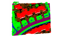
Learning from old maps to create new ones
Description: Maps are quickly becoming outdated, about 10 % of the objects change annually. This project focuses on methods to automatically interpret newly acquired sensor data to detect and to update the changed objects in the digital map. The sensor data includes high-resolution 2D aerial image data and 3D laser scanner data. Our approach is to use the existing (old) digital maps to learn how various objects appear in these 2D and 3D datasets. The first step is to design a fusion step between nationwide map data and sensor data to be able to generate a massive training dataset. The second step is to set up a deep learning network for the classification of the sensor data into the learned map classes. The third step handles the incorporation of the detected changes in order to update the map.
Partners: Miramap Aerial Surveys, NEO BV, Het Waterschapshuis, Waterschap Drents Overijsselse Delta, Netherlands Red Cross 510 Global, SVB-BGT, RVO
Sponsor: NWO, Applied and Engineering Sciences (AES)
PhD: Jiao, Anjanappa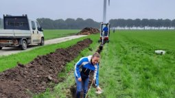
Wunder Project
As a result of climate change, extreme droughts are expected to occur more often in the Netherlands, potentially causing social distress and huge economic damages.
The WUNDER project will develop an integrated modeling system for understanding the behaviour of soil and vegetation during prolonged drought events. The system will enable to explore scenarios and evaluate strategies for managing, planning and adapting agriculture and nature systems to extreme droughts. The project will actively engage with farmers, water managers and other decision makers and develop practical use cases for daily drought monitoring and prediction, thereby supporting climate-robust production systems and water management.
The WUNDER consortium is designed as a collaborative as a whole in order to effectively exploit existing and develop new knowledge at the local to national scale by addressing three scientific challenges (WP1-3) related to drought events that are projected to increase due to climate change. We do so by conducting field measurements and develop integrated modeling tools for different agriculture and nature systems (WP1) and combining these data with satellite observations to scale the gained knowledge and tools up to national level (WP2, WP3) for timely and effective agricultural and water management from farm to national scale via two innovative applications (WP4, WP5). We have coherently co-designed, together with our stakeholders, five interlinked work packages (see Figure 1) to address the three major scientific challenges and the two innovative applications (as corresponding to five hypotheses).
Figure 1 Coherence and synergy of the integrated WUNDER system and the WPs
Workpackages
We have coherently co-designed, together with our stakeholders, five interlinked work packages
Find out more about the subjects.
Wunder News
Find here the newest Wunder updates
WUNDER in news
https://www.itc.nl/news/2022/3/479520/nwo-kic-grant-to-ut-research-on-water-use-during-droughtshttps://www.utoday.nl/news/71099/-15-million-for-ut-research-to-mitigate-drought-damagehttps://www.h2owaternetwerk.nl/h2o-actueel/wunder-project-onderzoekt-watergebruik-bij-extreme-droogtehttps://www.utwente.nl/en/research/themes/resilient/news-and-events/newsletter-v1/wunder-project/
Workshops & Meetings
WP1 Kick-off meeting (to be organised)
Deltares Meeting on Observation Plan
Agenda
STEMMUS-SCOPE Overview
First Results for Dutch Sites
Simulating Mixed Vegetated Site
WP5 Kick-off meeting
Agenda
Kick-off meeting
Agenda
WP0 Slides
WP1 Slides
WP2 Slides
WP3 Slides
WP4 Slides
PARATUS
Promoting Disaster Preparedness and Resilience by co-developing stakeholder support tools for managing the systemic risk of compounding disasters
PARATUS is a Horizon Europe-funded project that aims at increasing the preparedness of first and second responders in the face of multi-hazard events and to reduce the risks related to impacts on various sectors that result from complex disasters. The outcome is to develop a cloud-based Online Service Platform that offers support in reducing dynamic risk scenarios and systemic vulnerability caused by multi-hazard disasters.
In order to achieve these objectives, the project will perform in-depth assessments of complex interactions between hazards and their resulting impacts in various sectors, as well as analyse the current risk situation and study how alternative future scenarios could change multi-hazard impact chains. Based on this analysis, scenarios of multi-hazard impacts will be co-designed with stakeholders and developed in four case study areas (including the Caribbean, Romania, Istanbul, and Alpine areas).
SHAKEN
Post-earthquake Monitoring of Seismically-induced chains of Landslide Hazards (SHAKEN) for Protection of Critical Sites and Infrastructure
EarthSafe
EarthSafe aims at supporting the energy transition in Europe and beyond by creating transformational data-fusion platforms to inform and enhance global exploration frameworks for deep geothermal resources and critical minerals.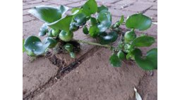
Water hyacinths: Use them or lose them?
Improving human and ecosystem health by bringing the science to the people of Lake Chivero, Zimbabwe (WHYimprove)
Water hyacinth (WHY) is an invasive species in (sub-)tropical inland waterbodies that clogs waterways and intakes and affects aquatic life and human activities, and may facilitate the spread of diseases. On the other hand, WHY can be exploited for biofuel production and other sources of income. A sustainable solution to water hyacinth infestation “uses” WHY instead of only attempting to “lose” them. This project uses scientific studies of data collected on site, in the lab and from satellites, combined with stakeholder experiences to co-create such solutions for Lake Chivero, the main source of drinking water to Harare, capital of Zimbabwe.
Figure 1: Schematic of the holistic approach of the WHYimprove project (pictograms by flaticon.com)
To be both effective and sustainable, new strategies to manage WHY need to be developed with a holistic view that accounts for humans, society and the ecosystem; users and managers; scientists and stakeholders. Our approach is composed of four elements:
Fundamental scientific research into causes and effects of WHY and degraded water quality, in which we recognise WHY both as a symptom and as a biomarker of degraded water quality. The research rests on the two pillars of satellite data and local field workCollection of stakeholder perspectives – particularly those of local farmers, fishermen, and women, but also, e.g., water managers and healthcare professionals – and integration into the development process of WHY management strategiesEngaging stakeholders by co-creation efforts from the beginning throughout the project up to, and including its end and evaluation; and by participatory science projects that provide ownership of the WHY management challenge and potential solutionsKnowledge sharing by providing open-access data, tools (mobile phone apps and a dashboard), open-access journal articles, a low-level newsletter, and by educating women on water quality and hygiene
Workpackages
These elements are addressed in six work packages:
Our project will impact the health of the lake ecosystem and the well-being and living conditions for people relying on lakes and reservoirs. This will lead to increased resilience of the ecosystem and its resident communities. Specifically, we aim for three domains of impact:
More healthy and resilient lake ecosystems;improved well-being of people depending on lakes; andmore resilient lake communities.
By integrating scientific findings from satellite and empirical data from local communities with stakeholders’ perspectives and recommendations, we will contribute to more resilient lake socio-ecosystems. Linking the health of humans, animals, and their environment (like in the One Health approach) can be useful in mitigating and preventing water-related diseases. The mobile phone applications and the WHY management dashboard are schematically depicted in Fig. 2.4. Together with the WHY management strategies, the MSU undergraduate course, and citizen science projects developed within WP6, they form the main output of the project.
News and calendar
Communication
Contact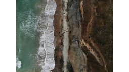
HE- OBSGESSION
HE - OBSERVATION OF ECOSYSTEM CHANGES FOR ACTION (OBSGESSION)
Region: Europe
Description: The objective and key ambition of OBSGESSION is to predict and monitor biodiversity and its direct and indirect drivers in terrestrial and freshwater ecosystems through the integration of state-of-the-art multi-sensor Earth Observation (EO) imagery, innovative in-situ (including citizen science) data, and products, together with next-generation ecological models. This aim goes well beyond the current state-of-the-art in combining the various data sources, modern modelling and uncertainty estimation. The methodological principles include firm anchoring into science and policy needs, true interdisciplinarity between terrestrial and freshwater as well as EO and ecosystem modelling disciplines, and FAIR and open science practices, including sharing of research outputs with both the scientific community and the civil society.
Partners:
SUOMEN YMPARISTOKESKUS Finland CoordinatorUNIVERSITEIT TWENTE Netherlands PartnerWCMC LBG UK PartnerUNIVERSITAT ZURICH Switzerland AssociatedLUNDS UNIVERSITET SE PartnerVLAAMSE INSTELLING VOOR TECHNOLOGISCH ONDERZO BE PartnerSTICHTING WAGENINGEN RESEARCH NL PartnerCENTRE NATIONAL DE LA RECHERCHE SCIENTIFIQUE CNRSFR PartnerPENSOFT PUBLISHERS BG PartnerBROCKMANN GEOMATICS SWEDEN AB SE PartnerBROCKMANN CONSULT GMBH DE Partner
Sponsor: European CommissionSpaceSUITE
SpaceSUITE will design, develop and deliver initiatives for better aligning the demand for new skills in the space downstream sector, and the educational offer across Europe by offering high-quality training courses. In addition, SpaceSUITE uses the skills intelligence it produces to implement a series of measures to better match the educational offer with the needs of the sector with the design and provision of new “core” curricula for HE and VET, supporting the development of a sense of initiative and entrepreneurial min-sets in the EU, as requested by the call.
XTREME
In this project, we remove these limitations by providing a mixed reality (MR) solution that, instead of requiring the participant to be physically present in the venue, brings the concerts and performances to a remote location via mixed reality technology while retaining the immersive experience, and even giving additional dimensions to it by mixing real and virtual content. Our solution also allows for virtually shared, realistic experience together with the selected social circles of the user. The solution removes the geographic limitations as by the mixed reality solution the concerts and performances can be accessed virtually from anywhere and they hence are more inclusive for people with limited access. Likewise, providing a global access to the art and music provides a globally wide audience for musicians and artists while the number of seats are not limited by the size of the physical venue. As this solution removes the necessity to travel to the concerts and performances, it provides a greener alternative to the traditional way of accessing a music and art experience.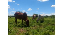
RANGE
RANGE (Resilient Approaches in Natural ranGeland Ecosystems) is a five-year project (2024-2028) funded by the Dutch Embassy in Kenya. It aims to strengthen the resilience of communities in Arid and Semi-Arid Lands (ASAL) in the Isiolo, Marsabit and Samburu counties. This will be achieved through multiple interventions and capacity-building activities.
The aim is to improve rangeland management, sustainable production methods, strengthen government structures, and better-informed decision-making through research and resulting evidence. This research will focus on combining local knowledge with earth observation solutions and geospatial techniques, and be carried out in part through offering scholarships to local PhD and MSc students. RANGE also intends to build strong partnerships with other institutions, building upon ongoing local and national initiatives.
Partners: Mercy Corps, FCDC and Faculty ITC of the University of Twente
Sponsor: Dutch Embassy in KenyaOSCT: Impuls Open Science Community Twente
Impuls Open Science Community Twente (Zurita&Schuberth)
COMBINED
How do changes in biodiversity and climate affect each other in Dutch landscapes? That question is at the heart of the COMBINED project. In addition, COMBINED will synthesise the effects of existing management measures and identify what barriers stand in the way of implementing successful measures. In this project, 24 Dutch societal organisations and knowledge institutes team up for six years. The project website will follow!
Partners: The COMBINED project 'Combatting biodiversity loss and improving climate change resilience through evidence-based, integrated, and adaptive landscape governance in the Netherlands' is led by Prof. Wieteke Willemen of University of Twente together with University of Utrecht, Wageningen University, HAS Green Academy, and partners from Leiden University, Hogeschool Van Hall Larenstein, Naturalis, InHolland, Hanzehogeschool Groningen, AERES, PBL, Natuurmonumenten, Staatsbosbeheer, Municipality of Groningen, Municipality of The Hague, Urgenda, LTO Nederland, BoerenNatuur, Landgoed Twickel, LandschappenNL, Province of Gelderland, Province of Utrecht, Bij12, FrieslandCampina.
Sponsor: NWO
Motivation and Engagement in Disaster Mapping in Europe (MEDiME)
Horizon Europe - MEDiME
The 2021 European floods, which claimed the lives of 243 people, served as a significant indicator of the far-reaching impact of climate change. These floods caused catastrophic damage to some of the most technologically advanced countries in the region. They also highlighted a notable fact: despite the extensive advancement of disaster maps and preparedness measures throughout Europe, the lack of individual preventive behaviour had a significant impact. In response to this issue, the MSCA-funded MEDiME project aims to mitigate the disadvantages posed by this lack. It seeks to achieve this by developing a crucial theoretical framework to motivate and engage residents in disaster training and preparedness. Additionally, the project focuses on continuously improving the effectiveness of such training.
Objective
"We should not be seeing this number of people dying in 2021 from floods. It just should not be happening." Hydrologist H. Cloke’s words echoed the widespread shock following the death of 243 people in some of the wealthiest and most technologically advanced countries in the world during the European 2021 floods. Extreme weather events such as floods and heat waves are expected to increase in frequency and intensity in the future (IPCC). As communities grow more exposed to hazard risks, in addition to state preparedness and urban resilience, it is urgent to address public involvement in disaster preparedness (DP) measures to promote individual preventive behaviour (SFDRR 2015-2030). Despite EU advances in Disaster Maps (DM) tools and disaster management procedures of community professionalisation, DM are used mostly by expert stakeholders but are seldom user-friendly for citizens, and current DP initiatives suffer from limited public motivation and engagement. People do not exist in a vacuum, and social and cultural dynamics play a crucial role in defining risk and motivation to engage in DP. Thus, DP strategies should include a systematic assessment of the impact of socio-cultural and spatial factors on people’s motivation and engagement in DP to inform better disaster training. The Motivation and Engagement in Disaster Mapping in Europe (MEDiME) project proposes a theoretical framework of motivation and engagement and a new disaster training based on interactive HM to investigate motivation and engagement in DP and the use of DM for foreign residents. An original socio-cultural and spatial model to understand people’s motivation to participate in DP initiatives based on the Japanese DP research and measures will be implemented, for Japan has always been at the forefront of DP for high levels of community engagement and mainstreamed DM. Project results will increase the impact of EU DP strategies, and inform useful DM uses for the broader public."
For more details, see: Motivation and Engagement in Disaster Mapping in Europe | MEDiME | Projekt | Fact Sheet | HORIZON | CORDIS | European Commission
Activities
MEDiME activities bring together research, innovation, and collaboration to better understand and enhance engagement in disaster preparedness and hazard mapping literacy. We combine social science insights with digital tools and serious games to explore how people contribute to, learn from, and are motivated by mapping initiatives in preparation for natural hazards and evacuation scenarios.
MEDiME work, then, spans a variety of areas — from research studies and workshops to data analysis, educational outreach, and partnership events. Each activity is designed to strengthen connections between communities, researchers, and decision-makers, fostering a more resilient and informed approach to disaster management across Europe and beyond.
Collaborations
MEDiME thrives on international collaboration. We are proud to work with outstanding institutions and researchers from around the world who share our passion for advancing disaster mapping, motivation, and engagement research.
So far, we are fortunate to have established collaborations with:
Università degli Studi di Messina, Messina (Italy)JST-Mirai project (Japan)Kyushu University, Fukuoka (Japan)SHOCKTRACKER project, Stockholm (Sweden) Tohoku University, Sendai (Japan)
We are always open to new partnerships that can help expand the reach and impact of our work.
If your institution is interested in collaborating with the MEDiME project, please contact our Principal Investigator, Dr Irene Petraroli, at i.petraroli@utwente.nl.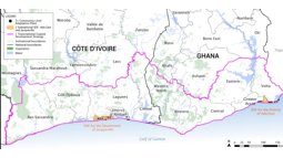
Increasing Coastal Resilience in Côte d'Ivoire and Ghana
People ECCO
Region: International
Description: Effective ecosystem conservation and restoration are crucial to halt global biodiversity loss and to mitigate the effects of global climate change. Civil Society Organizations (CSOs) and Non-Governmental Organizations (NGOs) are key actors in achieving an effective conservation and restoration of ecosystems, as these multifaceted organizations work on the interface of project implementation, education, public policy advocacy and research.
The two overarching goals of the PEOPLE-ECCO project are to (i) engage CSOs/NGOs active in ecosystems conservation by involving them in the co-design of Earth Observation-supported methodologies applicable in their operational practices and though EO capacity building activities, and (ii) develop, test, demonstrate and validate EO-integrated methods, based on the identified user requirements and co-design. Building on existing EO initiatives and projects, the EO solutions developed in this project will bring in elements of novelty to answer two parallel conservation objectives: monitoring conditions and management effectiveness of existing protected areas (Objective A), and site suitability identification of high-priority areas to be protected (Objective B).
Partners: Hatfield Consultants (Canada), DHI (Denmark), 52°North (Germany)
Sponsor: ESA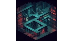
European Citiverses Uniting for Inclusiveness
Transformative Leap in Urban Digital Innovation
The European Citiverses Uniting for Inclusiveness (CU) project represents a transformative leap in urban digital innovation, delivering an inclusive, accessible digital twin tailored to the needs of the wide diversity of citizens and visitors, regardless of age or ability. By integrating state-of-the-art technology with user-centric and universal design, this initiative sets a new benchmark for smart, sustainable urban development in line with the EU Digital Strategy.
Collaborative Approach to Digital Inclusivity Across Europe
Our collaborative approach, combining expertise from different sectors, promises to deliver a scalable, replicable model that improves quality of life and drives digital inclusivity across Europe.
The University of Twente’s Role in Gamification Strategy
From the University of Twente, we are tasked with strategizing the gamification of the user experiences within this digital twin platform, essentially designing an engaging game-like platform for people with different abilities to engage in social activities with each other.
Incorporating Gamification to Enhance Engagement and Accessibility
Our role is specifically to incorporate gamification elements into the solution to increase user engagement. This could potentially include developing interactive features and reward systems to motivate users to explore more extensively, designing gamified portals to enable travel to different locations, and providing location-based services such as meaningful social networking. We aim to make the platform as accessible as possible to online participants, who may have limited access to physical environments, through gamification and an immersive digital twin.
Official website of the European Citiverses Uniting for Inclusiveness Project
"The project represents a transformative leap in urban digital innovation, offering an inclusive, accessible digital twin tailored to the needs of the broad diversity of citizens and visitors - no matter age or abilities." https://www.lindholmen.se/en/european-citiverses-uniting-inclusiveness
AgriCEM
The European Space Agency’s (ESA) Sentinel Users Preparation (SUP) project “Advanced Agricultural Monitoring with Copernicus Expansion Missions (AgriCEM)” aims at
Generating a representative dataset for the hyperspectral CHIME and the thermal LSTM missionDeveloping and testing advanced vegetation stress products using CHIME and LSTMInvolving stakeholders and end-users
Synthetic CHIME and LSTM data will be generated using an end-to-end simulator combining the Soil Canopy Observation, Photochemistry and Energy fluxes (SCOPE) model and the OHB Remote Sensing Image Simulation Environment (RISE). The parameterisation of vegetation in the SCOPE model will be configured for sugar beet based on the data provided by the partner company QZ Solutions and the champion user KWS (a seed company). The output of the SCOPE model (i.e. top of canopy reflectance images) will feed into the OHB simulator, which simulates the acquisition geometry, the optical effects and noise within the instrument, and the ground processing chain including atmospheric correction. Based on the simulated datasets of CHIME and LSTM and their synergistic use, we will develop retrieval algorithms for vegetation biophysical and biochemical traits (ITC, OHB), land surface temperature (LST, LIST) and evapotranspiration (ET, LIST), and several vegetation stress indicators of different complexity (LIST, ITC) . AgriCEM aims to demonstrate the added value of the new hyperspectral instruments and higher resolution LST, compared to the currently available multispectral and coarser resolution sensors and develop beyond state-of-the-art stress indicators. The generated synthetic images and the algorithms will be made available to the scientific community and stakeholders. Let's get ready for the new era of Copernicus Expansion missions!
Partners
OHB System AG (OHB; coordination)University of Twente, ITCLuxembourg Institute of Science and Technology (LIST)QZ SolutionsKWS (champion user)
Study areas
Sugar beet fields in Poland, Italy and Germany.
CHIME and LSTM
CHIME - Copernicus Hyperspectral Imaging Mission for the Environment – revisit time 12.5 days – spatial resolution 30 m – > 200 bands in VIS-NIR-SWIR 400-2500 nm https://www.eoportal.org/satellite-missions/chime-copernicus#mission-capabilities
LSTM - Land Surface Temperature Monitoring – revisit time 4 days – spatial resolution 50 m – 5 TIR bands 8-12 um (sensor characteristics at the ITC sensor database https://webapps.itc.utwente.nl/sensor/getsen.aspx?name=LSTM)
Both missions' launch is planned for 2028.
Agricem Midterm Meeting 2025
The EO ASCENT Team joined the Mid-term Review meeting and created a series of videos about the project and insights from ESA, partners, and stakeholders.
General overview
Espen Volden, ESA project manager
Marek Wiciak, Top Farms Glubczyce
Zbigniew Kawalec, QZ solutions CEO
Marco Spagnolli, OHB systems engineer
Laura Schyrba, KWS scientist
Disclaimer
The view expressed in this publication can in no way be taken to reflect the official opinion of the European Space AgencyCGIAR Universiteit Bordeaux
No information available.EARTHONE
The mission of EARTHONE is to address the pressing issue of preserving and enhancing Earth's natural terrestrial GHG sinks by understanding how different drivers, including socio-economic, demographic, and physical constraints affect GHG fluxes. The project adopts a unique and interdisciplinary approach, integrating state-of-the-art data-driven technology with regional context (with a special focus on the most vulnerable areas in south and Mediterranean Europe including Spain, Greece, Italy, Slovenia, Croatia and North Macedonia) through living labs to offer effective multi-target solutions and guideline to all stakeholders in LULUCF topics. For this goal, EARTHONE will develop:
1. And concurrently implement a complete multi-Tier methodology through effective land management activities for sustainable agriculture and forestry towards the optimization of GHG fluxes and promoting the resilience of habitats towards climate change adaptation in the LULUCF sector. This methodology incorporates procedures for adequate risk-based management and a complete evaluation and validation framework.
2. An entire end-to-end framework, supporting the evidence collection for GHG inventory, at vulnerable plots in Europe to quantify improvements in the activities performed. This system is compatible with the European Green Deal Dataspace normative and guidelines. This approach tackles the challenges of data integration and governance to support the development of a set of tools, that will exploit external data sources including, but not limited to, (1) satellite imagery and products from NASA e.g. Landsat, Moderate Resolution Imaging Spectroradiometer (MODIS), and European Space Agency (ESA) e.g. Sentinels and other datasets from the COPERNICUS initiative; (2) meteorological agencies, other sources: Spanish Meteorology Agency AEMET, Hellenic National Meteorological Service HNMS, European Centre for Medium-Range Weather Forecasts ECMWF, Bonn conference, IPCC reports, etc., (3) environmental data including European Environmental Agency, International Soil Reference and Information Centre, European Soil Information System, Natura Habitats, Biodiversity Information System, highlighting the CORINE and HR-VPP services.
3. A suite of cutting-edge biophysical, statistical, and AI models will assist landowners, environmental experts, and policymakers in making optimized decisions backed by scientific evidence. These models encompass tailored tools for global climate predictions via land use management, integrating GHG considerations, and regional climate modeling through sensitivity analysis to ensure effective management under future conditions.
4. A set of local actions to gather evidence and recommendations with the objective of scaling up to minimize socio-economic and environmental risks. This evidence will be used as a basis for providing guidelines for the adaptation of national and supranational environmental policies.HURRICANE
According to the World Meteorological Organization, the frequency of severe weather incidents, such as hurricanes, droughts, wildfires, flooding, has quintupled over the last five decades, causing more than 100 000 fatalities and 1.5 trillion euros of economic losses in Europe (EU) . The wildfires and floods experienced by EU countries in summer 2023 confirmed that these natural disasters are a significant challenge to address over the years to come. On the other hand, despite a decreasing trend, technological disasters, man-made hazardous events, caused more than 150 thousand of deaths over 2000-2021 period, one of the last most important events being the explosion in the port of Lebanon in 2020 . This additional pollution leads to greater vulnerability among populations and the degradation of ecosystems. Consequently, disaster management capabilities need to be enhanced in this fast-evolving context. Robotics can play a crucial role to improve first responders’ safety and effectiveness in their operations. Indeed, Unmanned Ground Vehicles (UGV) and/or Unmanned Aerial Vehicles (UAV) can provide useful tools to map the environment in risky conditions, providing data related to the intervention site or people location without sending people on the field. This is an active field of research, as witnessed by several EU projects, such as ResponDrone , Intrepid . However, limitations are still holding back these cutting-edge innovations from becoming a disaster management standard. Regarding UGVs, disruptions can be caused either by the loss of lines of sight with the control station, either by navigation issues resulting from perception module failures, as camera images can be significantly degraded with fog or smoke – this one being particularly relevant for hazardous events – or by high complex environment such as urban areas. Moreover, high demanding data processing is required for effective data-driven tactical management in real operational scenarios, challenging communication infrastructures subjected to disturbances as well as computing times for evacuation planning or disaster evolution models. HURRICANE will unlock the potential of UGVs operation in hazardous environment, relying on enhanced vision capabilities, innovative resilient communication, relying on innovative UAV-UGV cooperation pathways, and smart integration over a holistic, resilient and real-time situational awareness infrastructure. Data-driven optimization models will provide recommendations through a user-friendly API to support first responders’ tactics. Three complementary pilots will be implemented to demonstrate the benefits brought by HURRICANE solutions. Last, but not least, EU-wide training modules will be implemented to raise awareness among first responders about these innovative technologies, integrating new operational procedures.
Senior Expert at Livestock Agri-Food Systems
Description: Livestock productivity is critical for pastoralists in semi-arid Africa, who largely depend on milk and meat production for their livelihoods. Climate variability strongly influences this productivity; for example, African rangelands face frequent droughts that can lead to livestock loss through reduced availability of forage and water. At the same time, livestock affects climate through the emission of greenhouse gases, although large uncertainties exist in emission estimates over rangelands. Satellite remote sensing can help to reduce some of those uncertainties, and provide important information on rangeland conditions and management. This can help to design, promote, and monitor resilient livestock production systems. As part of the NL-CGIAR partnership, this Senior Expert assignment contributed to ILRI’s agenda on sustainable livestock production systems and drought risk management by exploring options for improved rangeland monitoring using earth observation satellites.
Partners: ILRI
Sponsor: NWO-WOTRO
Contact:TDCCs Incrreasing literacy
Geospatial machine learning (ML) models are widely used in scientific and (semi)operational settings by geoscientists, ecologists, agronomists, engineers, spatial planners, public health specialists, etc. These models and the methods to develop them are continuously evolving and changing rapidly, making it difficult to keep up with them. While some researchers and practitioners are proficient in the development, application and (re)use of ML models, others are lacking the basic knowledge required to harvest the benefits of geospatial ML models. Additionally, ML modelling remains an art and modelers do not always document their creative process. To address these problems, we propose creating a geospatial ML course that increases geospatial ML literacy as well as the (re)usability of geospatial ML models. The geospatial ML course would not only provide researchers with foundational knowledge and skills, but also with the opportunity to stay updated with the latest advancements. Although generic ML courses exist, using ML with geospatial data is different from other domains, as
the spatial aspect introduces domain specific challenges (e.g., ways to deal with spatial autocorrelation). Moreover, the variability, volume and dimensionality of geospatial data often brings data integration and processing challenges. Next to this, modelers often look for geographical and physical consistency whereas this is not automatically guaranteed by ML algorithms. Additional challenges include the selection of methods to properly evaluate geospatial ML models, the delineation of their domain of applicability so that they (re)used in a responsible manner and the identification of suitable ways to combine geospatial ML and legacy (mechanistic, mathematical, process-based) models. In short, the proposed course will provide valuable insights into the development and application of ML concepts, while addressing the unique requirements of geospatial data. Finally, we highlight three hallmarks of the proposed course: 1/ we will develop it using opensource tools and solutions. This will help to scale up our work, allowing (sub)disciplines to reuse, expand and modify our materials; 2/ we will explore and test ways to ensure model FAIRness and reproducibility by adopting and adapting open-source (MLOps) tools and solutions. This will lead to more transparent and (re)usable models that can better support policy/decision making, and 3/ we will involve the research community from the beginning of lesson and educational material development, to adapt the material to their use cases, and to continually gather their feedback.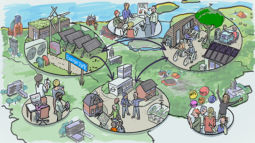
SYNERGY: Social dYnamics in eNergy systems: Resilience, Governance and Trust
NWO has awarded €2.85 million to a University of Twente-led NWA (National Science Agenda) project that contributes to more inclusive and equitable energy policies. The SYNERGY project investigates how behaviours such as cooperation, resistance, and collective action emerge in local settings like neighbourhoods, energy hubs, and energy communities. This transdisciplinary project aims to produce practical tools and knowledge that governments and practitioners can use to design more effective, fair, and adaptive energy policies.
A key principle of SYNERGY is energy justice: ensuring that everyone, regardless of their resources or background, has the opportunity to participate in, and benefit from, the energy transition. This includes addressing inequalities in access to renewable energy systems and in the decision-making processes that shape them.
The project, SYNERGY, focuses on social dynamics and addresses the question of how to make the energy transition fairer and more inclusive. Le Anh Long, from the Faculty of Behavioural, Management, and Social Sciences (section PA), coordinates the project and works together with colleagues Thomas Hoppe (BMS-CSTM), Sikke Jansma (BMS-CS), Peter Stegmaier (BMS-KiTES), Ewert Aukes (BMS-CSTM), Imad Ibrahim (BMS-CSTM) and Marco Gerards (EEMCS-CAES). The grant falls under the NWA Call 'Social dynamics in the energy transition. From theory to practice, which aims to deepen understanding of how social behaviour and interactions influence the energy transition.
A strong collaboration across universities and practice
SYNERGY is a collaborative effort involving partners across the Netherlands. Alongside the University of Twente, the consortium includes TU Delft, TU Eindhoven, Tilburg University, Utrecht University, Avans University of Applied Science, TNO, and several partners from practice, including energy cooperatives. By bringing together academic expertise and real-world perspectives, the project bridges research and practice to support policymakers, energy hubs, local communities and individuals.Finished projects
- ProjectFacultyThemesProject managerPeriod

Measuring pedestrian dynamics
While understanding pedestrian behavior is essential for many aspects of urban design, planning, and management, monitoring of pedestrians often intrudes a person's privacy. Therefore, in this project funded for by NWO, we develop a framework with novel technological solutions toward measuring pedestrian dynamics to answer urban-related questions in a privacy-preserving and socially acceptable way.
Sentinel2Height
The Sentinel2Height is an ESA-funded project that develops a new framework for mapping forest canopy heights using coherence images derived from Sentinel-1 Synthetic Aperture Radar (SAR) data. The project bridges existing gaps in space-based Lidar data, such as GEDI and IceSat-2., by using Sentinel-1's frequent and all-weather coverage to estimate forest heights. It aims to provide a wall-to-wall, cost-effective, reliable, and timely method for monitoring forest height, thereby facilitating better forest management and conservation strategies.
The project is structured around several key objectives:
Create a Cross-Modal Forest Benchmark Dataset: The project aims to develop a benchmark database that includes Sentinel-1 SAR coherence images and forest height measurements from space-based Lidar systems such as GEDI and IceSat-2. The database will adhere to FAIR (Findable, Accessible, Interoperable, Reproducible) and Open Science principles. Develop a CNN Model Customized for Forest Height Mapping: The objective is to create a deep learning model based on a convolutional neural network (CNN) designed for SAR-derived coherence images. The model will be trained using the cross-modal benchmark database and used to enable forest height estimation using Sentinel-1 SAR data.Demonstrate and Validate the Cross-Modal Benchmark and CNN Model: The project will assess the performance of the cross-modal benchmark database and CNN model using four selected case study areas. The results will be shared publicly and published in open-access resources.Produce an Open Processing Tool: The project will develop an open-source tool, Sentinel2Height, which will allow users to process Sentinel-1 SAR images and estimate forest height. This tool will be made publicly available, accompanied by user-friendly documentation and open-source code, ensuring that it can be accessed and utilized by a broad range of users.Ensure the Long-Term Availability of the Benchmark Data and Tool: The project will ensure the sustainability and continued availability of the developed dataset and tool by storing them in open repositories (e.g., GitHub, Zenodo) and promoting their use for future research and advancements.
The project is funded from the European Space Agency (ESA) in response to the Tender Action Number 6-60008 and Activity Number 1000037670. It kicked off on January 15, 2025.
Consortium partners: The University of Twente, The Netherlands (prime contractor), Università degli Studi di Napoli Parthenope, Italy, Aalto University, Finland, and ETForestService group, Finland.LAND-at-scale
LAND-at-scale aims to contribute to fair and just tenure security, access to land and natural resources for all. This will lead to more sustainable and efficient use of land and natural resources for food, housing and production. It will also reduce conflicts and competing claims over land.
ITC is responsible for the preparation, execution, and processing of participatory fit-for-purpose field data collection and public inspection in pilot areas; and subsequently the flow of collected data to the responsible organizations.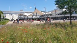
Searching for Oil Spills on Sea Surfaces
Description: Oil spills rapidly spread on sea surfaces covering wide areas, assuming different appearances and thicknesses. Due to currents and winds, continuous slicks break into smaller fragments which can reach coastal ecosystems and lead to adverse environmental and socio-economic impacts. The faster the actions to detect, stop, and contain the released oil from spreading, the higher the Oil Spill Response (OSR) success rate. Clean-up effectiveness is higher over thicker oil layers, referred to as "actionable oil". Detecting these regions is crucial to guide response vessels allowing a better deployment of barriers and skimmers, enhancing mechanical oil recovery efficiency, in situ burning tasks, as well as aerial-based dispersant application.
Under this scenario, "Searching for Oil Spills on Sea Surfaces" (SOSeas) will employ the latest generation of deep learning methods for semantic segmentation to develop an artificial intelligence (AI) based system to identify relative oil thicknesses by using Synthetic Aperture Radars (SAR). Oil slick characterization is a new, promising and highly innovative research area with great perspectives owing to the availability of free and open Earth Observation products, and to the effectiveness of machine learning algorithms combined with high-performance computing infrastructure based on graphical processing units (GPUs).
A team of scientists and key stakeholders from diverse research institutes, governmental agencies, and private companies are composing the project's advisory panel. This multidisciplinary and intersectoral panel merges complementary skills and expertise within academic and operational scenarios, consolidating an important research network. It is expected that a deep learning architecture well-trained on large-scale datasets to recognize oil thickness variations has the potential to indicate the location of recoverable oil, thereby improving situational awareness, decision-making, and clean-up effectiveness.MIRAMP
The work consists of developing an automatic classification process for water bodies in LiDAR datasets that meets the AHN specifications, optionally expanded after mutual agreement with additional tasks in the field of LiDAR and photogrammetry.
SmartAvocado
Sustainability without borders - connect distant production and consumption with SmartAvocado
REAL-TIME TRACKING OF FOOD FLOWS USING THE INTERNET OF THINGS TECHNOLOGIES AND GEOSPATIAL DATA
Our project
Food today is often produced thousands of kilometres away from where it is consumed, making it challenging to track the farm of origin and routes. Current norms in science use country origins and national aggregates, oversimplifying the environmental impacts that can vary 50-fold across farms.
The Smart Avocado project is experimenting with a monitoring system to track avocados, an imported, water-hungry product, using the latest Internet-of-Things technologies. The Smart Avocados are GPS-equipped avocado replicas deployed in real avocado production sites in South Africa. By transmitting their exact geolocation, the trackers allow tracing the journey of the fruit, from the production site to the packhouse, from country roads to the cargo ship, and finally to the local reseller in the Netherlands. This creates a high-resolution map of food flow, enabling our understanding of the environmental impact of the avocado trade.
The Smart Avocado project aims to pave the way for improved monitoring methods of food flows. Through enabling the monitoring of the origin and the trajectory, we can ultimately improve our understanding of the environmental impact of imported food (such as water use and CO2 emissions). Our vision is to encourage sustainable consumer behaviours and business models to govern sustainable food trade.
Presentation video
You found a Smart avocado?
Involving stakeholders
The journey of the avocado impacts a wide range of stakeholders, from producers and exporters working toward greater sustainability to consumers, governmental organisations, NGOs, and consumer associations advocating for increased transparency and fair prices. To foster collaboration and shared understanding, the Smart Avocado Team hosted a stakeholder engagement meeting on January 15th, 2025. The event brought together over 30 participants from South Africa and Europe who have stakes in the avocado food flows, to inform them about the project, gather insights for future collaboration, and address their needs and feedback.
Watch the recording of the meeting here
Our partners
Smart Avocado is an NWO-funded project. We are partnering for this research with the University of Limpopo and the local community and supply chain actor, Westfalia Fruit.
Piloting a co-design approach for climate-sensitive blue and green spaces with vulnerable urban populations
Description: Blue and green spaces hold many benefits for human health, particularly in the context of climate change. They provide cooling effects and reduce air pollution, and safeguard mental and social well-being. The most disadvantaged parts of the population often miss out on nature’s benefits due to a lack of such spaces nearby and barriers related to infrastructure, stigma, and lack of involvement in planning processes. We aim to counteract these barriers by considering their needs and including them in urban planning processes. We use geoinformation systems and artificial intelligence for visualising and exploring potential changes to the city landscape, and involve these population groups, as well as decision-makers, in a participatory co-design approach.CopPhil
Description: CopPhil project is ESA-funded, and led by CLS and focuses on EO service development and transfer. The scope of this project is to offer an operational Copernicus service focused on three EO pilot services for users in the Philippines. It has three topics: Ground motion, Benthic habitat, and Land classification. We are contributing to the ‘Ground motion’ topic, aiming to design an InSAR processing chain using open-access tools and integrate it with Geoville’s created processing environment. We shall improve time series InSAR data processing and InSAR method improvement for large volume data processing and cloud computing, and data interpretation with several pilot test sites in the Philippines for 1) landslide, 2) seismic activity and 3) (urban) subsidence. Sentinel-1 SAR data, for at least three years, shall be used. Ultimately, we shall provide an InSAR service (like EGMS, https://egms.land.copernicus.eu) and products to local users in the Philippines and offer tutorials and short courses to them.
Project website: TBD
Partners: CLS, TRE-Altamira, GMV, GeoVille, ARGANS, INDRA, PLUS, ALSO Space, SpaSe
Sponsor: ESA
ESA LUISA
Land Use Intensitys potential, vulnerability and resilience for Sustainable agriculture in Africa
Description: Over Africa, land use intensification is a subject of particular research interest. The African land system is undergoing rapid changes and novel approaches are needed to understand the drivers and consequences of land use intensification, as well as the dependency, vulnerability and resilience caused by climate change. It is paramount to understand Africa’s potential, vulnerability and resilience for sustainable agriculture, defined as one that is low-carbon, resource-efficient, and socially inclusive.The primary objective of this activity is to develop and implement new methods, effectively linking and integrating modelling, satellite EO products (Sentinels, Explorers, Meteo missions, ESA-CCI) and dataset with in-situ, stakeholder-generated, social-economic data to advance the estimation of continental Africa potential, vulnerability and resilience for sustainable agriculture.ASTRAIOS
Description: Starting in January 2023, and over the course of the three years, the ASTRAIOS project will identify the existing space-related education and training across Europe, project future demand for space skills from the European space industry, and identify actions to align and improve the career pathways into the sector.
Partners: ESF, AZO, S4S, UStrath, EASN, ISU, TUC, FDC, SSA
Statistics from Space
Statistics from Space, Next Generation Agricultural Production Information for Enhanced Monitoring of Food Security in Mozambique (Partners)
Region: Mozambique
Description: The project will produce and disseminate accurate agricultural production statistics data based on Earth observation data, digital field data collection and spatial analytics and modelling. The aim is to generate production information in a sufficiently timely manner so that all market participants can use the information for decision-making.
Partners: International Food Policy Research Institute (IFPRI), University of Twente/ITC (ITC), Centro de Estudos de Políticas e Programas Agroalimentares (CEPPAG), Seoul National University (SNU)
Sponsor: The Ministry of Agriculture, Food and Rural Affairs of the Republic of Korea
Contact Person: Florian Ellsäßer, Claudia Paris, Furkan Çelik and Robert OhuruTailormade training GASGI
The training course will be offered three times within a two-year time frame. Each course has a different invoice of 55k, and the first one has already been paid.
HyRelief
Region: Kenya
Description: HyRelief enhances the thermal instrument on board the International Space Agency (ECOSTRESS) drought monitoring products with a new generation of hyperspectral satellites (ENMAP+PRISMA).
Partners: CNR-IREA, BOKU, University of Milan, University of Milan-Bicocca, RCMRD, ILRI, NDMA
NASA-JPL/ECOSTRESS
NASA’s ECOSTRESS mission on the International Space Station was designed to measure evaporative plant stress on a near-global scale. We propose a novel way to use ECOSTRESS thermal data to investigate thermal hotspots in soils and rocks at the Earth’s surface. These thermal anomalies are important in the reconnaissance of new geothermal resources, a vital source in the global energy transition towards a more sustainable energy supply. The aim of this proposed work is to optimize the geothermal temperature anomaly detection from space by using a different and novel approach. We will look at the nighttime temperature decay rates in time series, rather than temperatures in individual time slices. This approach will provide hypothetical stabilization temperatures at the end of cooling, even if that stable temperature is not reached at the end of the night for a given pixel. The proposed approach will side-step two issues that current state-of-the-art methodologies are struggling to handle: 1) the effect of solar heating and starting temperature at the beginning of the night are inconsequential for our result, as our focus is on decay rates rather than on absolute temperatures, and 2) variations of thermal inertia in the geologic substrate are controlled by looking at the stable end temperature which are inertia independent. In order to reconstruct the nighttime cooling patterns for each image pixel, we propose to merge data from the unique precessing ECOSTRESS orbit (different acquisition times on different overpass days) with data from geostationary weather satellites. This merged product will provide a super-temporal resolution time series, with the high spatial details from ECOSTRESS and the high temporal details from the weather satellites. This study will investigate for the first time the nighttime cooling dynamics of the geologic substrate in ECOSTRESS images, and assess its potential for improved near-global geothermal anomaly detection.TRuStEE
Trustable and Sustainable Water and Ecosystem Management
Remote sensing (RS) data at a range of scales from proximal observations to global extent sampling can detect essential changes in plant traits (PTs), biodiversity and ecosystem functioning, providing a method for scaling-up. However there are still methodological and technical constraints that hamper a systematic incorporation of RS in ecosystem models, including scalability and multi-source data integration issues.
TRuStEE will train a new generation of scientists with complementary and interdisciplinary skills in ecosystem modelling, plant physiology, RS technologies and big data analysis, addressing the specific objectives: 1) to identify essential biodiversity variables (EBVs) and the link with PTs and ecosystem functional properties (EFPs), inferable from RS, 2) to investigate a completely new avenue for assessing vegetation photosynthetic efficiency from RS measurements of canopy fluorescence, 3) to assimilate diverse RS data streams with varying spatial and temporal resolution in dynamic ecosystem models and 4) to exploit new satellite missions (e.g. ESA-FLEX, ESA-Sentinels, NASA-GEDI) and EO products for the upscaling of PTs, EBVs and EFPs. The early stage researchers (ESRs) involved will strongly benefit from the network of internationally recognized scientists and private companies with relevant expertise in these topics. The cooperation program proposed will link academic and non-academic participants to allow the circulation of ESRs giving them the opportunity to become new research and innovation leaders in the most cutting edge sophisticated technologies in the field, increasing their employability in both academic and private sectors.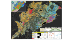
Enabling Crop Analytics at Scale
This project was a part of the “Enabling Crop Analytics at Scale” program, supported by the Bill and Melinda Gates Foundation and managed by Tetra Tech’s AGDATA Acceleration Facility. In this collaborative project, IFPRI, in partnership with aWhere, ITC, and ICRISAT, addressed two interlinked bottlenecks in the collection of ground-truth data for crop analytics: 1) ineffective sampling strategy at the landscape scale, and 2) inefficient yield measurement at the field level. The project used terrestrial remote sensing and 3D imaging technologies at strategically chosen locations in Odisha, India, to improve both crop yield measurement accuracy and its representativeness for the surrounding landscape. Tthe project team developed a new, scalable crop yield measurement approach based on Dynamic Area Sampling Frames (DASF) and 3D imaging technology using the Terrestrial Laser Scanning (TLS) and the Structure from Motion (SfM) approaches.
Partners: IFPRI, ITC, ICRISAT, AWhere
Sponsor: Bill and Melinda Gates FoundationBioDiversa+
To report on their footprint, businesses may need to use biodiversity data that they collect themselves. This often raises concerns about intellectual property and the risk of disclosing sensitive information. In addition, understanding the different standards and infrastructures for data sharing can be complex. We aim to develop a practical guide to help businesses share biodiversity data in line with the FAIR principles, addressing common concerns and providing guidance on the use of standards and key infrastructures.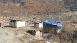
Healthy Waters Integrated
Vulnerable groups at the margins of societies in Europe, such as Roma people, often live in informal settlements, where they are excluded from access to safe drinking water, sanitation, and waste management. Understanding the extent of related high health risk and providing assistance through targeted interventions are complicated by the invisibility of this group and the inaccessibility of reliable, up-to-date information.
We aim to improve the acquisition of information on water insecurity and related health risks among Roma communities and develop an innovative assessment system that integrates social, medical, geoinformation, and earth observation science methods.
Publications
Anthonj, C., Dadrass Javan, F., Ihnacik, L., Blišťaň, P., Papajova, I., 2024. Strengthening water and health security in Europe’s marginalized communities through integrated social, geographical, medical and technological approaches (HealthyWatersIntegrated). Newsletter Working Group Medical Geography 2(2024), 8-10.
Anthonj, C., Setty, K.S., Ezbakhe, F., Manga, M., Hoeser, C., 2020. A systematic review of water, sanitation, hygiene and environmental health among Roma communities in Europe: Situation analysis, cultural context, and obstacles to improvement. Int J Hyg Env Health 226 (113506). https://doi.org/10.1016/j.ijheh.2020.113506
Anthonj, C., Stanglow, S., Flacke, J., Dadrass Javan, F., Ihnacik, L. Strengthening water and health security in Europe’s marginalized communities, presented at 20th International Medical Geography Symposium in Atlanta, Georgia, US, 15-19 July 2024.
Team members
Farzaneh Dadrass Javan (University of Twente, The Netherlands)Lukáš Ihnacik (Slovak Academy of Sciences and University of Veterinary Medicine and Pharmacy in Košice, Slovakia)Peter Blišťaň (Technical University of Kosice, Slovakia)Ingrid Papajova (Slovak Academy of Sciences in Košice, Slovakia)
EO4CerealStress
Region: Worldwide
Description: This project aims to power a classic geography model Gravity with artificial intelligence, to model the food movements between places.
Despite advances in agricultural production, approximately 800 million people around the globe still face severe food insecurity. Biotic and abiotic agricultural stressors reduce and limit productivity (e.g., yield reduction) and ecosystem services (e.g., loss of carbon sequestration). These devastating impacts are increased by climate change, particularly by frequent and stronger extreme weather events.
EO4Cerealstress will evaluate the synergistic use of multi-source Earth Observation data, particularly hyperspectral data, in-situ crop physiological parameters, soil, climate, and other ancillary data- taking advantage of their complementarity - to understand the effects of multiple stressors and their cumulative effects on crops. New and planned European satellite missions are providing data at high spatial, spectral and temporal resolutions, which offer the opportunity not only to understand and monitor the impacts of single crop stressors but also multiple crop stressors. The project aims to develop products that can be used to monitor these stressors and provide a scientific roadmap for the future development of EO products and techniques for monitoring multiple crop stressors.
Partners: University of Southampton-UK, University of Natural Resources and Life Sciences (BOKU)-Austria, University of Seville-Spain, University of Guelph-Canada, EODCMINERVA
MINERVA: Dutch network on Microwaves for a New Era of Remote sensing of Vegetation for Agricultural monitoring
Funded by NWO PIPP (Partnerships for Space Instruments & Applications Preparatory Programme) (May 2020 – April 2024)
Project Objectives
Establish and maintain a long-term collaborative network of knowledge institutes and commercial entities involved in the use of microwave remote sensing of vegetation for agriculture and food security. Inventory new opportunities for vegetation monitoring from candidate missions (e.g. CIMR, ROSE-L, Harmony, HydroTerra), and provide a roadmap towards their exploitation in key applications related to agriculture and food security.
Research Contents
Monitoring and modeling of vegetation in the natural environment needs to consider several challenges in estimating the scattering and emission properties of the vegetated land surfaces. When only a bare soil surface is considered, the dominant factors that determine the scattering and emission signatures are soil surface roughness and the dynamic soil moisture and soil temperature profiles. For a vegetated land surface, the vegetation itself also causes scattering and emission signatures, in addition to its attenuation of the signatures from the underlying soil surface. The presence of the vegetation complicates both components by the interactions of the signals in the vegetation-soil system but also provides the needed signature for monitoring vegetation. The key challenge for remote sensing of vegetation is to be able to describe and separate the contributions of the different components in the observed total signature of the vegetated lands.
In the MINERVA project, we intend to systematically study and contribute to understanding the precise scattering-emission mechanism of vegetated lands. We will focus on following three activities:
Assembling in-situ observation of scattering-emission of vegetated surfaces to develop a multi-frequency simulator for synthesizing data from future microwave missions. Integrated modeling of MW scattering-emission and optical-thermal (MV-OPT-TIR) signatures. The optimally combined optical and microwave data is expected to be used to retrieve bio-geophysical variables and information at the scales required by users.Application of the MW-OPT-TIR model for understanding the functioning of agroecosystems.
Figure 1 STEMMUS-SCOPE model (for understanding soil-water-plant-energy interactions) will be coupled to air-to-soil transition model, discrete scattering model (TorVergata), as well as the advanced integral equation model (AIEM/I2EM). The development of such multi-frequency (MV-OPT-TIR) forward observation simulator will contribute to the development of Community Land Active Passive Microwave Radiative Transfer Modelling Platform (CLAP)
PartnersAgriScience
Hidden Hunger
EO4Nutri will develop innovative scientific solutions that bring together the capabilities of various Earth Observation (EO) data through novel methods and approaches to estimate and predict the nutrient content of soil, crop canopy, and harvested crops for several global staple grains: maize, rice, sorghum, teff and wheat. This will advance our knowledge in better understanding, mapping, and monitoring nutritional quality of crops. In terms of the investigated nutrients, we will focus on those with high relevance to human nutrition and plant growth: Calcium (Ca), Iron (Fe), Magnesium (Mg), Nitrogen (N), Phosphorus (P), Potassium (K), Selenium (Se), Sulphur (S), and Zinc (Zn). These nutrients are deficient in many countries across the globe. Zn deficiency, for example, is the most ubiquitous micronutrient deficiency in crops worldwide (Alloway 2009) and was the best predicted in HyNutri. It is estimated that about 17% of the world population suffers from Zn deficiency (Kumssa et al. 2015). Fe was also well-predicted in HyNutri. Twenty-five percent of the global population is Fe deficient (Radlowski and Johnson 2013). Se was not assessed in HyNutri, but it is also deficient in many crops around the world (Alloway 2008). For example, the Italian Institute of Research on Agriculture and Nutrition (INRAN) reported that the rice produced in Italy is characterized by a low content of Se (Spadoni et al. 2007).
CO-DESIGN
Co-design for climate sensitive urban spaces with disadvantaged populations
Blue and green spaces hold many benefits for human health, particularly in the context of climate change. They provide cooling effects and reduce air pollution, and safeguard mental and social well-being. The most disadvantaged parts of the population often miss out on nature’s benefits due to a lack of such spaces nearby and barriers related to infrastructure, stigma, and lack of involvement in planning processes.
We aim to counteract these barriers by considering their needs and including them in urban planning processes. We use geoinformation systems and artificial intelligence for visualizing and exploring potential changes to the city landscape, and involve these population groups, as well as decision-makers, in a participatory co-design approach.
Publications
Anthonj, C., Schrammeijer, B., Foellmer, J., van Rompay, T., Willems, W., Cerrone, D., Bockarjova, M., Kabaria, C., Musyoka, D., Janeka, P., Sawungrana, AR, Owaga, D., Martinez, J., 2024. Urban blue and green spaces for well-being of disadvantaged population groups, presented at 20th International Medical Geography Symposium in Atlanta, Georgia, United States, 15 – 19 July 2024.
Anthonj, C., 2024. Water, Health and Decisions, presented at Jahrestagung des Arbeitskreises für Medizinische Geographie - Gesundheitliche Ungleichheiten in einer Welt im Wandel in Koenigswinter, Germany, 19 – 21 September 2024.
Anthonj, C., 2024. Involving those often not considered in decision-making, presented at Co-design panel at VU-UT Alliance day in Enschede, Netherlands, 4 October 2024.
Sawungrana, A.R., Janeka, P., Schrammeijer, B., Martinez, J., Cerrone, D., van Rompay, T., Willems, W., Anthonj, C., 2024. Co-Design Approach for climate-sensitive blue and green spaces with disadvantaged urban populations, presented at UT Climate event in Enschede, The Netherlands, 5 November 2024.
Anthonj, C., Schrammeijer, B., Janeka, P., Sawungrana, A.R., Cerrone, D., van Rompay, T., Willems, W., Martinez, J., 2024. Co-design approach for climate-sensitive blue and green spaces with disadvantaged urban populations, presented at Workshop on Adaptation and Citizen Science Projects for Resilient Cities, 22 November 2024.
Team members
Bep Schrammeijer (Athena, VU)Javier Martinez (University of Twente | ITC)Damiano Cerrone (UrbanistAI)Azzadiva Ravi Sawungrana (University of Twente | ITC)Paula Janeka (University of Twente | ITC)Thomas van Rompay (University of Twente | BMS)
This project is funded by the collaboration of VU Amsterdam-University of Twente awarded to the impact programme Creating Responsible Societies, Dr. Carmen Anthonj at the University of Twente and Dr. Bep Schrammeijer at VU University.ESA MOST-NRSCC Dragon 5
Monitoring and Modelling Climate Change in Water, Energy and Carbon Cycles in the Pan-Third Pole Environment (CLIMATE-Pan-TPE)
The Third Pole Environment centred on the Tibetan plateau and the Himalayas feeds Asia’s largest rivers which provide water to 1.5 billion people across ten countries. Due to its high elevation, TPE plays a significant role in global atmospheric circulation and is highly sensitive to climate change. Intensive exchanges of water and energy fluxes take place between the Asian monsoon, the plateau land surface (lakes, glaciers, snow and permafrost) and the plateau atmosphere at various temporal and spatial scales, but a fundamental understanding of the details of the coupling is lacking especially at the climate scale. Expanding westward from the Third Pole, the Pan-Third Pole region covers 20 million km2, encompassing the Tibetan Plateau, Pamir, Hindu Kush, Iran Plateau, the Caucasians, the Carpathians, and is home to over 3 billion people. Climate change is expected to dramatically impact the water and energy as well as carbon cycles in the Pan-TPE area and consequently alter the water resources, food security, energy transition and ecosystems as well as other related societal challenges. Monitoring and modelling climate change in Pan-TPE reflect key societal issues and contribute to the science component to other international initiatives, e.g. UN sustainable development goals (SDG), GEO societal benefit areas and the ESA EO science for society strategy.
Objectives
Improve process understanding of the interactions between the Asian monsoon, plateau surface and atmosphere (in terms of water, energy and carbon budgets);Assess and monitor changes in cryosphere and hydrosphere; Model and predict climate change impacts on water resources and ecosystems in the Pan-Third Pole Environment.
Work Plan
Figure 2 Monitoring and modelling Water and Energy Cycles at Climate Scale in the Third Pole Environment (CLIMATE-TPE)
WP1: Observation and modelling of microwave scattering and emission under complex terrains with permafrost and freeze-thawing conditions. (supported by researches from the MINERVA project)WP2: Advancement of physical understanding and quantification changes in water and energy budgets in Pan-TPE.WP3: Advancement of quantifying changes in surface characteristics and monsoon interactions.WP4: Modelling and predicting climate change impacts on water resources and ecosystems in the Pan-Third Pole Environment.
PartnersIntelliGeo
Our project seeks to revolutionize the way we create geographical models and maps. By integrating advanced AI language models with open-source geographical platforms, we will craft a solution where AI and human experts can collaboratively design intricate models. Imagine a tool that assists in developing models that detect flood-prone areas, estimate crop yields, or predict environmental shifts. This research is about realizing such intelligent modelling. In doing so, we are advancing geographical modelling and, simultaneously, championing a European approach to AI that emphasizes human expertise and collaboration. This is the future of geographical modelling, where humans and AI co-create.TDCC NES, ENABLING BEST PRACTICES FOR SUSTAINABLE SOFTWARE IN THE NATURAL & ENGINEERING SCIENCES
The main goal of the ODeDaI project is to transition the Data Foundry platform to a sustainable open-source development platform and to allow for more customization in how institutions can collect design data. Other universities and institutions should be able to run Data Foundry per institution or as a joint infrastructure, while benefiting from structural compatibility, continuous development and shared practices.Bridging the gap between Artificial Intelligence and society
Description: The future of our planet is one of great urgency but also great opportunity. Drones now provide imagery offering unprecedented detail and Artificial Intelligence (AI) can translate such images into information at remarkable accuracy. AI is expected to support the monitoring and representation of several Sustainable Development Goal indicators, especially in low-income countries. Yet society is wary of adopting these technologies, since complex and uninterpretable results can affect the accountability of decision- and policy-makers wishing to benefit from AI. The objective of this project is to leverage societal requirements to tailor artificial intelligence algorithms to societal needs by focusing on responsible and viable AI for geospatial applications. Responsible AI, here considered as fair and explicable AI, must lead to trustworthy geo-intelligence by identifying bias and facilitating transparency by design. Only then can their predictions be used reliably in development applications.
Space4Restoration
About Space4Restoration
Region: Multiple case study sites worldwide (now Netherlands and Lebanon more to come)
Description: The worldwide restoration of degraded ecosystems is crucial to halt biodiversity loss and to mitigate the effect of global climate change. The effective restoration of degraded terrestrial, inland water, and marine and coastal ecosystems was included as one of the global targets for 2030 of the Kunming-Montreal Global Biodiversity Framework, is a key component of the new EU’s Nature Restoration Law, and is the core of the UN Decade on Ecosystem Restoration that started in 2021.
Restoration initiatives across the globe are aiming to improve the state of nature, and simultaneously provide nature’s crucial benefits to people. Credible and meaningful monitoring and evaluation of these efforts is needed to learn from past and ongoing initiatives, and to make wiser decisions for new restoration actions. The Space4Restoration project aims to design, test and finetune scalable online earth observation-based methods to monitor and evaluate restoration actions across biomes. In this project, we build on the work pioneered by ITC and in very close collaboration with organisations working on international restoration standards, and practitioners for test sites and user perspectives.
As underlying method, Space4Restoration uses counterfactual analyses (“What would have happened if the intervention hadn’t taken place?”) to assess the effectiveness of restoration interventions. We base these analyses on datasets provided by restoration practitioners, complemented by free and open satellite earth observation datasets (e.g., Sentinel-1 and 2, Landsat), and other spatial data such as weather, soil, topography maps. Space4Restoration embraces Open Science and all developed software tools will be shared under a permissive license through the project’s code sharing GitHub page (see https://github.com/Space4Restoration)
Partners: Lebanon Restoration Initiative, Natuurmonumenten
Sponsor: ITC Ingenuity
AlignSAR project
Description: The AlignSAR project aims to develop open-access methods and tools to offer FAIR-guided open SAR benchmark dataset library designed for SAR-based artificial intelligence applications, while ensuring interoperability and consistency with existing and upcoming initiatives and technologies, facilitating wider exploitation of SAR data and its integration and combination with other datasets. This library will contain meaningful and accurate SAR signatures created by integrating and aligning multi-SAR images and other geodetic measurements in time and space.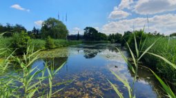
Water4Change
Description: The Water4Change research programme addresses the complex challenges to urban water systems faced by fast-growing cities in India. India is a country which is rapidly growing into urban agglomerations showing infrastructure deficits and adaptation gaps in relation to current and future climatic, societal and economic change. The programme embraces water as a basic necessity for life that is both an agent and catalyst of positive transformative changes that are needed to pro-actively deal with and respond to these challenges. To facilitate long-term sustainability and resilience of urban water systems, the programme will co-create and mainstream an integrative, fit-for-purpose and adaptive water sensitive design framework in close collaboration with stakeholders in three Indian cities. The framework will be developed by synergistically connecting four realms – governance, built and natural environment, technology and infrastructure design and societal behaviours – for the delivery of transformative change.
Partners: Dutch Partners: Delft University of Technology, Erasmus University (DRIFT), University of Twente, IHE Delft Institute for Water Technology, Deltares, IRC Wash. Indian Partners: Indian Institute of Technology Roorkee (IITR), Indian Institute of Technology Gandhinagar (IITG), Maulana Azad National Institute of Technology (MANIT), CEPT University Ahmedabad, Centre for Water Resources Development and Management (CWRDM) Calicut
Sponsor: NWO & DST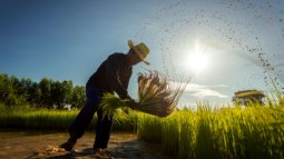
EO4Nutri
Description: EO4Nutri focuses on developing innovative scientific solutions that bring together the capabilities of various Earth Observation (EO) data to estimate and predict the nutrient content of the soil, crop canopy, and harvested crops for several global staple grains.
Partners: ITC (EOS and NRS department), National Research Council of Italy (CNR)/Institute for electromagnetic sensing of the environment (IREA), University Milano di Bicocca, Rothamsted Research, Ludwig Maximilian University of MunichCODECHECKing goes NL
A lot of research outputs rely on computational methods. Open science principles ask for those to be shared and to be reproducible. However, in traditional scientific publishing, those methods are rarely checked for soundness. With this project we aim to not only check at least 50 pieces of research software to see if the results in the associated scientific article can be reproduced with the provided code, but also to convince editors to include such a check in their publication process. The suggested roadshows will bring code reviewers (so called codecheckers), authors and editors together to implement codechecking in a sustainable way.Pangkalan Kerinci
The CONSULTANT aims to address the need for validation and enhancement of LiDAR technology for accurate tree inventory data collection. It includes evaluating the effectiveness of field procedures, pre-processing methods, and post-processing techniques to ensure that LiDAR can be relied upon for consistent and accurate tree inventory data collection. The goal is to provide actionable recommendations to improve the overall efficiency and accuracy of LiDAR-based forest inventory.
PlasticFree
Region: the Netherlands
Description: with societal partners, PlasticFree project integrates behavioural and spatial science to address plastic usage in grocery shopping behaviours.
Sponser: UT-VU AmsterdamESA DRAGON: Advanced training courses in China
The DRAGON advanced training courses in China are international courses that train researchers in the use of satellite Earth observation data for applications such as climate, water, and agriculture, while strengthening collaboration between European and Chinese institutions
RiskPACC
RiskPACC will provide an understanding of disaster resilience from the perspective of citizens and CPAs, identifying resilience building initiatives and good practices led by both citizens (bottom-up) and CPAs (top-down).Zadeldakenanalyse
Analysis of rooftop line, in the context of integral heightprovision for the Netherlands.
VeVuSafety
Description: Traffic safety is the fundamental criterion for vehicular environments and many artificial intelligence-based systems like self-driving cars. There are places, e.g., intersections and shared spaces, in the urban environment with high risks where vehicles and vulnerable road users (VRUs) such as pedestrians and cyclists directly interact with each other. By advancing state-of-the-art artificial intelligence methodologies, this project aims to build a privacy-aware deep learning framework to learn road users’ behaviour in various mixed traffic situations for the safety of vehicles and VRUs.
VeVuSafety proposes a 3D environment model based on a 3D point cloud for privacy protection — private information like license plates and faces is anonymized. Then, within this environment model, an end-to-end deep learning framework using camera data will be built for multimodal trajectory prediction, anomaly detection, and potential risk classification based on deep generative models such as the Variational Auto-Encoder. Besides road user safety and privacy, VeVuSafety can help traffic engineers and city planners to better estimate the design of traffic facilities in order to achieve a road-user-friendly urban traffic environment.
Fig. 1 project profile and work packages
Partners: Leibniz University Hannover, Nara Institute of Science and Technology (NAIST), VISCODA GmbH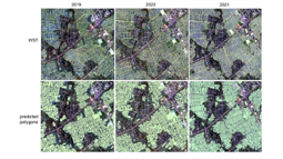
EO4Diversity
Biodiversity Precursors – EO4Diversity (2021)
Region: International (ESA)
Description: EO4DIVERSITY addresses important biodiversity science gaps, including forecasting ecological degradation in order to define effective actions to reduce terrestrial biodiversity loss.
Partners: Stichting Wageningen Research, Vision on Technology for a Better World (VITO), the Centre National de la Recherche Scientifique (CNRS), Lund University, the UN Environment Programme World Conservation Monitoring Centre (UNEP-WCMC), the Finish Environment Institute (SYKE) and the Remote Sensing Laboratory of the University of Zurich (RSL / UZH).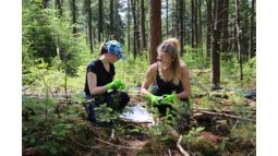
BIOSPACE
The BIOSPACE project aims to monitor biodiversity by upscaling field observations and genomic (eDNA) information using next-generation satellite remote sensing
Partners: Wageningen University, Macquarie University, Nationalpark Bayerischer Wald, SYKE, Stichting Het Nationale Park de Hoge Veluwe, NatuurmonumentenNuffic
Application for a TMT course entitled "Empowering Agricultural Development in Jordan through Geoinformatics Capacity Building" with Yarmouk University in Jordan as partner. The course will be designed as a mixture of e-learning and face2face teaching at the different stages of the training.Tailor made training Senegal 2023 2024
ITC-WRS and eLEAF B.V. conducted a series of tailor-made training (TMT) for the Center of Ecological Monitoring (Centre de Suivi Ecologique, CSE) in Dakar, Senegal. The TMT was funded by the Dutch Orange Knowledge Programme (OKP).
The training covered priority themes for Senegal: (i) Water (ii) Climate & Environment through long-term impact goals:
Water efficiency in agriculture increased (Water)Earth-observation-based environment monitoring techniques improved (Climate & Environment)Early warning and monitoring systems for disasters (bushfires, floods, droughts, oil spills) implemented (Climate & Environment)
Part 1: Python basics
The main request of CSE was to familiarize staff members with Python programming language for GIS and EO image processing. As such, the pre-training part in December 2023 focused on Miniconda installation and common packages for NetCDF (xarray), GeoTiff (rasterio) and shape file (geopandas) operations, along with the JupyterLab for interactive coding and visualization. The icing on the cake was the application programming interface (API) data access of Copernicus Data Space Ecosystem (CDSE) through openEO.
Part 2: WaPOR
The second part of the training was delivered by eLEAF and focused on the Food and Agriculture Organization of the United Nations (FAO) Water Productivity Open-access portal (WaPOR) data usage for Crop Water Productivity (CWP) computations and Irrigation Performance Assessment (IPA) in the Senegal River delta. In addition, a whole-country drought assessment with the Standardized Precipitation Index (SPI) was conducted. Participants presented their case study results to the guests from the Embassy of the Kingdom of the Netherlands.
Part 3: Python for EO
The final part of the training was devoted to Python applications for Earth Observation data. This part carried on with the Senegal River delta study area for automated parcel delineation (image segmentation with scikit-image), land surface phenology metrics extraction and object-based crop type mapping. The topic of water quality (chlorophyll content and turbidity) and water pollution with oil spills was delivered by Suhyb Salama online. On the final day, a FastFlood App developed by Bastian van den Bout and ITC-AES colleagues was showcased.
Tailor Made Training material
The course materials and Python notebooks are hosted by the ITC educational platform (Moodle learning management system) under TMT Senegal.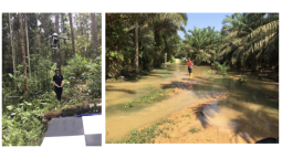
EFForTS
Ecological and Socioeconomic Functions of Tropical Lowland Rainforest Transformation Systems (Partners)
Country: International
Description: Due to population growth and the increased demand for palm oil from the industry, many farmers have decided to cultivate oil palm on their terrains and many large-scale oil palm plantations have been established. However, transforming forests or diverse agroforest landscapes into these monoculture plantations may have dramatic consequences for the environment. EFForTS aims to gain in-depth knowledge about the working of forests and different forms of oil palm cultivation, and how to maintain or restore ecosystem functions on these plantations.
Partners: Deutsche Forschungsgemeinschaft (German Research Foundation), University of Göttingen (Germany), IPB University (Bogor, Indonesia), Tadulako University (Palu, Indonesia) and University of Jambi (Indonesia).
Sponsor: University of Göttingen
Gezond Omgaan met Hitte en pollen in een veranderend klimaat
In a ZonMw-funded research project, several researchers are joining forces to understand annual hay fever dynamics. The project determines under which (weather) conditions, where in the Netherlands, how much pollen is released into the air by plants, and how the pollen moves through the air. It also examines how different levels of pollen exposure affect the burden of disease, and therefore which trees are best to plant or not to plant. Finally, it discusses with people who suffer from hay fever how they currently manage their symptoms and what information they would like to have in order to reduce the nuisance.
Project leader: Dr. EllenWien Augustijn
Project members: Prof.dr.ir. Raúl Zurita Milla, Dr. Rosa Aguilar
See also: Large differences in hay fever progression 2021 and 2022 (itc.nl)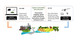
Spatial sustainability joint education
Region: the Netherlands
Description: As part of the strategic collaboration ambitions between the Vrije Universiteit (VU) Amsterdam and the UT this project explored the options for joint education on the topic of spatial sustainability. The Institute for Environmental Studies (IVM) of the VU and UT-ITC have strong research programmes on the social and environmental dimensions of land systems and their sustainability challenges. We however identified a gap in our education programmes. Students at the VU get limited training in technical skills to map, model, and monitor land systems in space and time, while students at the UT get limited exposure to social, economic and policy aspects that steer and shape land systems. In order to 1) Improve visibility of the sustainability MSc programmes at the VU and UT for BSc students leading to increased student mobility, 2) Stronger education to address pressing real-life sustainability challenges society faces with respect to land use, and as such 3) increased employability and impact of students aiming to work on these sustainability challenges, we explored the options of setting up a joint BSc minor, exchange MSc course materials, and facilitate joint MSc thesis supervision. The team organized student workshops at the VU and UT, spoke with teaching staff, reviewed education materials and the many administrative documents relevant for the organization and implementation of education. The project findings, SWOT analyses, and recommendations and requirements to move forward will be presented to the two universities soon.
Sponsor: VU-UT Collaboration Fund
Partner: Institute for Environmental Studies (IVM) Vrije Universiteit Amsterdam
Land tenure for peace
Land in Peace is a Colombian-Dutch project to formalize and register land ownership in post-conflict areas through an innovative, fast and transparent methodology. The University of Twente/ITC is a partner in this project coordinated by Kadaster International.FLEX/S3 PARCS
focuses on preparing the ESA FLEX satellite mission by developing methods to measure vegetation and photosynthesis from space, often in synergy with Sentinel-3 data. It supports improved ecosystem monitoring and contributes to climate and agricultural research.WHEGS
Wat Heet Eanske Greune Stad
Funded by: Province of Overijssel
Main objective
Implement real-time urban climate monitoring network in Enschede
Work Packages & Tasks
1. Management
Coordination (ITC-WRS)Business perspective (ME)
Enschede already started an initiative indicating urban heat stress
2. Measurement - Implementation
Technical realisation and deployment (EWI-PS).Implementation (ITC-WRS)
Building a “citizen-science” climate observation network for Enschede
3. Data processing
Data integration and visualization (EWI-CT)Data analysis (ITC-WRS)
Analysis (Example on-line Majisys database)
Partners
Municipality of Enschede (ME)
University of Twente
Faculty EWI-Pervasive Systems (EWI-PS)
Faculty EWI-Creative Technology (EWI-CT)
Faculty ITC-Water Resources (ITC-WRS)TIGER BRIDGE
TIGER BRIDGE – TCBF Phase 4 is a follow-up phase of the TIGER programme, focusing on strengthening and connecting African institutions in the use of satellite Earth observation for water management. It emphasizes sustainable implementation, collaboration, and knowledge exchange.
iAqueduct
An integrative information aqueduct to close the gaps between global satellite observation of water cycle and local sustainable management of water resources
Project Summary
The past decades have seen rapid advancements in space-based monitoring of essential water cycle variables, providing products related to precipitation, evapotranspiration, and soil moisture, often at tens of kilometer scales. Whilst these data effectively characterize water cycle variability at regional to global scales, they are less suitable for sustainable management of local water resources, which needs detailed information to represent the spatial heterogeneity of soil and vegetation. The following questions are critical to effectively exploit information from remotely sensed and in situ Earth observations (EOs): How to downscale the global water cycle products to the local scale using multiple sources and scales of EO data? How to explore and apply the downscaled information at the management level for a better understanding of soil-water-vegetation-energy processes? How can such fine-scale information be used to improve the management of soil and water resources?
iAqueduct aims to close the gaps between satellite water cycle products and local information necessary for sustainable management of water resources, and will address the abovementioned scientific questions by combining medium-resolution (10 m–1 km) Copernicus satellite data with high-resolution (cm) unmanned aerial system (UAS) data, in situ observations, analytical- and physical-based models, as well as big-data analytics with machine learning algorithms.
iAqueduct complements the actions developed under the European Strategy Forum for Research Infrastructures (ESFRI) by coordinating a set of European research groups and sites allowing the scaling up to pan-European level under the aegis of the COST action Harmonization of UAS techniques for agricultural and natural ecosystems monitoring (HARMONIOUS) in which 70 institutions from 32 countries participate.
iAqueduct collaboration, coordination, mobility, synergies
HARMONIOUS - IAQUEDUCT Joint Fieldwork
iAqueduct Consortium
EU/H2020 - INGENIOUS
New technology for the first responder of the futureTISCALI
Technology Innovation for Sewer Condition Assessment
A large challenge in the urbanising world of the 21st century is the proper maintenance and rehabilitation of the buried sewer system. Intelligent use of multi-disciplinary, multi-level data that will be collected within this project from the integrated use of different inspection techniques, each focusing on their own specific scale, may be part of the solution. Integration of these datasets into a “smart” subsurface information system (SIS) will provide sewer asset managers with an invaluable instrument for sustainable and targeted management of their sewage system. Via the SIS, the approach integrates thermal infrared and ground penetrating radar remote sensing as well as robotic observational techniques for an objective assessment of the sewer condition at multiple stages, thereby contributing to bringing sewer asset anagement to the next generation.
Consultancy on food networks
Region: Rwanda and Guatemala
Description: The CGIAR Initiative on Digital Innovation (DI) aims to generate research-based evidence and innovative solutions using digital innovations to advance the inclusive and sustainable transformation of food, land, and water systems. Real-time monitoring of food systems is one such workflow where the expertise of external organisations can facilitate and strengthen on-going activities. The work of the University of Twente on domestic transport network analytics (e.g. Nelson et al., 2021), provides an opportunity for contextualisation of the diet quality and food flow mapping in Rwanda. An improved understanding of the interplay of transport networks on the flow of food items, and the (potential) subsequent impacts on diet quality could transform understanding of food environments and motivate timely interventions. Use of real-time and standardised food flow information would also provide validation opportunities for current modelling performed for Rwanda (Nelson, et al., 2021), which could have global relevance in demonstrating unforeseen frictions within localised systems.
The objective of this collaboration agreement is to generate a detailed map of Rwanda’s transport network, updating current analytics developed, to support DI. Specifically, the collaboration will seek to explore the potential for integrating commodity flow and seasonality information into the model, for a more detailed understanding of Rwandan food environments. The work will generate buy-in of governmental agencies and institutes workshop to better understand stakeholder needs to move toward scenario-based ‘What-if’ interface to demonstrate the sensitivity of food security to infrastructure and market mechanisms. Further, this collaboration will explore opportunities of expanding similar analyses in Guatemala, where parallel diet and food flow mapping are on-going.
Partners: IITA (International Institute of Tropical Agriculture)
Sponsor: CGIAR
Towards a green and more liveable Paramaribo
Region: Suriname
Description: Urban green spaces play an important role in the quality of life in cities. Parks, lanes, gardens, green belts provide various benefits to our well-being. This includes cooling the direct environment, preventing erosion, promoting rainwater infiltration, aesthetics, and opportunities for recreation. With increased urbanization worldwide, the challenges for urban planning and keeping the city liveable are increasing. Climate change threatens to exacerbate this, for example with expected increases in temperature. The benefits of green spaces are not the same everywhere. So far, research has mainly been done in temperate regions such as in Europe and the US. What are the advantages of urban green spaces the tropics where vegetation and lifestyle are clearly different? And how can information and understanding help to motivate people to promote and protect greenery in the city? Tropenbos Suriname and the University of Twente have been working together since 2018 in a twinning context; we learn from each other. In Paramaribo, the capital of tropical Suriname, we aim better understand this role through remote sensing, spatial modelling and we are testing the use of small weather sensors to measure the cooling effect of vegetation. Beside this, we developed free teaching materials, are freely sharing all our data for use by others, and are organizing activities for residents (for more information click here). Citizens play a big role in this. Dozens of people, schools and societal organizations monitor the functions and use of green spaces on a monthly basis in order to gain knowledge of the changes and to share this knowledge with others in order to take smarter action.
Do you want to know more?
Read this article about our citizen science and innovation in IP magazine. (In Dutch)Listen to citizen researchers and Davita Obergh of Tropenbos Suriname how monitoring works (In Dutch)Or watch this short animation about green spaces in the city and why this research is important (Switch on the English subtitles)
Partners: Tropenbos Suriname
Sponsors: UTSN Twinning, NWO, ITC Geo-Citizen Science Seed Grant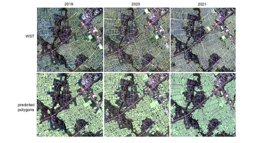
Biodiversity Precursors – EO4Diversity
Region: International (ESA)
Description: EO4DIVERSITY addresses important biodiversity science gaps, including forecasting ecological degradation in order to define effective actions to reduce terrestrial biodiversity loss.
Partners: Stichting Wageningen Research, Vision on Technology for a Better World (VITO), the Centre National de la Recherche Scientifique (CNRS), Lund University, the UN Environment Programme World Conservation Monitoring Centre (UNEP-WCMC), the Finish Environment Institute (SYKE) and the Remote Sensing Laboratory of the University of Zurich (RSL / UZH).
Sponsor: ESA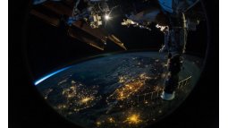
e-shape: EuroGEO Showcases: Applications Powered by Europe (2019)
Pioneering H2020 project e-shape, strengthens the benefits for Europe of GEO - establishing ‘EuroGEO’. It is the largest coordinated effort to highlight operational services in the field of Earth observation research in Europe. The project aims to improve user uptake of Earth Observation data in the region. It will develop operational EO services and demonstrate the benefits of the EO pilots at national and international scale, across vertical markets (private and public), and amongst key user communities. Through the coordinated downstream exploitation of EO data and existing EO resources, they will run 27 cloud-based pilot applications under 7 thematic areas to address societal challenges, foster entrepreneurship, and support sustainable development.
Partners: MLU, UT, SYKE, WENR
Sponsor: The European Commission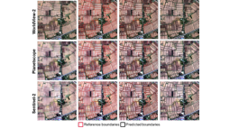
FAO Rice Field Boundaries
The project aims at developing a spatially explicit agricultural database in support of agricultural planning. The considered study areas are in Cambodia and Vietnam, where rice paddies occupy a substantial portion of the agricultural area. The obtained geospatial database of rice farms will be used to increase the availability and quality of farmland information to: (i) support the definition of effective schemes of farming incentives, (ii) support the formulation of smart agriculture/microfinance programs, and (iii) improve reporting on Sustainable Development Goal (SDG) 2.4.1 for sustainable agriculture. The project is supported by the Ministry of Agriculture, Forestry and Fisheries (MAFF) of Japan and implemented by the Statistics Division of the Food and Agriculture Organization (FAO) of the United Nations.
Partners: EOS
Sponsor: FAO
Challenge-Based Learning for UAV Photogrammetry Education
Challenge-Based Learning for UAV Photogrammetry Education (CBL4UAv)
Challenge-Based Learning aims at delivering education and knowledge by tackling and solving real-world challenges: teachers/mentors, stakeholders, and students are all involved in this process. In the general CBL framework, stakeholders from the public, private, and non-profit sectors bring the real-world challenge, while students develop the technical solution thanks to the support of the mentors. In this setting, students develop important practical skills and learn how to implement academic knowledge in practical situations which are not often covered in traditional academic education. This makes CBL particularly suitable for students from other domains that want to gain knowledge on Geospatial solutions to solve challenges in their domains. By using educational scaffolding techniques, the students and stakeholders will be helped on their way and will have an increasing amount of freedom to work on their challenges. The teacher ensures academic and content quality while delivering knowledge relevant to the perspectives of the students and stakeholders involved.
This study aims to implement and deliver guidelines on how to adopt CBL in an educational framework for teaching Geospatial education. The study is designed and handled in five main phases Engagement, Investigate, Act, and Evaluation, and in the last phase pilot is designed and developed to practice the designed framework on the main topics of food security and cultural heritage.
Outcomes
The designed framework with some available samples of implementation is publicly available here for those interested to reuse it for any educational activities. Please feel free to adopt and we will be happy to know about your experience via f.dadrassjavan@utwente.nl.
If you like to study a summary of CBL and the CBL4UAV project, you can use our Introduction to CBL presentation (File1, see below)The designed CBL Framework is also completely available for those who are interested to adapt or reuse it in their educational activities.
a. CBL-Engagement phase (file 2, see below)
b. CBL-Investigation phase (file 3, see below)
c. CBL-Act phase (file 4, see below)
d. CBL-Evaluation phase (file 5, see below)Also, we would like to publish some of our activity results achieved in the pilot phase (file 6, see below)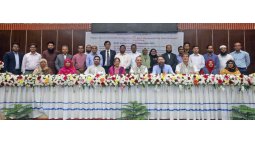
TMT+ Bangladesh
Region: Bangladesh
Description: Digital transformation in agriculture and information technologies based on the use of big geospatial data and technologies both play a key role in the solution to Integrated Food and Nutrition Security (FNS), including sustainable water resources management and climate change mitigation. This training project took part partially online, and physically in the Netherlands and Bangladesh. It aimed at building the capacity of BARI and BARC scientists in analyzing agro-geospatial big data in key research domains including crop mapping and yield prediction. Developed with BARI and BARC (Bangladesh Agricultural Research Institute and Council).
Partners: GIP
Sponsor: NUFFICFLEX/S3 Photosynthesis
focuses on measuring vegetation photosynthesis from space using satellite data (e.g. FLEX and Sentinel-3). It develops methods for improved ecosystem monitoring and supports research on climate change and agriculture.WETROPOLIS
Decision making, participation, education & outreach with physical and augmented hydrological models
Funded by: European Funding for Regional Development (EFRO)
Main objective
Develop and validate instruments for effective decision-support concerning climate adaptation
Work-packages
CoordinationTechniqueExpositionEducationParticipationDecision-makingDissemination
Different Technology Readiness Levels
WRS/ITC tasks
Sensing: Building a “citizen-science” climate observation network for Enschede
Analysis (Example Enschede website)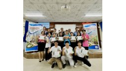
OKP TMT Vietnam
Region: Vietnam
Description: Capacity building on sustainable shrimp farming and mangrove restoration for climate resilient rural development in the coastal areas of the Mekong Delta, Vietnam.
Partners: Sustainable Aquaculture Solutions, Can Tho University
Sponsor: OKP NUFFICClimate Change Initiative and Knowledge Exchange
The consequences of a warming climate are far-reaching and are already affecting the atmosphere, land and ocean, and altering the main cycles governing the Earth system. With impacts on the natural environment and society for generations to come, climate change is high on political, strategic, and economic agendas worldwide.
To prepare for this challenge, ITC, under the Climate Change Initiative (CCI) and Knowledge Exchange project (https://climate.esa.int/en/), has developed Educational Resources which are learning materials for educators, students, and the interested public. The educational resources target three categories:
Climate for Schools; classroom resource packs for primary and secondary school childrenClimate for Science Excellence; tertiary education resources for self-study, a Massive Online Open Course and a Summer SchoolClimate for the public; playful games to understand aspects of climate change and the role of satellite data in monitoring it
Climate for Schools
https://climate.esa.int/en/educate/climate-for-schools/
The inspirational classroom resources are developed to engage pupils at age 8 to 17 to learn about Earth’s changing climate and how to monitor our planet from space.
These resources are available in five languages (English and Spanish, Dutch, German and French)
Classroom resources for schools
Climate for Science Excellence
https://climate.esa.int/en/educate/climate-for-science-excellence/
We at WRS ITC trust that education will equip the future generation of scientists and policymakers with the competencies to address and mitigate climate change.
Do you want to learn how to measure climate change?
Do you want to predict when extreme events will hit your country again in the future?
Then, you are invited to join our courses and Training For Science Excellence.
Tertiary education resources developed by ITC
The tertiary education courses are developed for graduates and postgraduate levels and offered in three flavours:
Self-study (Tertiary Training Kit); provides teaching and self-learning resources for teachers and students on the use of software and methods to analyse satellite-derived climate data records https://climate.esa.int/en/educate/climate-for-science-excellence/tertiary-training-kit/Massive Open Online Course (MOOC); an online course to explore how satellites are used for Earth Observation to support the climate science community and policy makers https://climate.esa.int/en/educate/climate-for-science-excellence/massive-open-online-course/Summer School; a short summer course aiming to equip the participants with the competency of evaluating climate change using satellite data and use state-of-the-art software to analyse essential climate variables https://www.utwente.nl/en/summer-school-curiousu/summer-course/true-climate-change/
Climate for the public
https://climate.esa.int/en/educate/climate-for-the-public/
Informal, interactive, playful activities that help to facilitate understanding of climate and climate change and climate data records – with an accompanying Facilitator Guide.
These games address the main triangle of climate change and the activities of the Climate Change Initiative of Monitoring the Environment and Living things.
Games for PublicGEONETCast
GEONETCast for Early Warning and Food Security - Ethiopia
is a system that distributes satellite-based environmental data globally via satellite communication, particularly to developing countries. It enables applications in areas such as agriculture, water management, and disaster monitoring.
Panoptis
PANOPTIS aims at increasing the resilience of road/highway infrastructures and ensuring reliable network availability under unfavorable conditions, such as extreme weather, landslides, and earthquakes. Our main target is to combine downscaled climate change scenarios (applied to road infrastructures) with simulation tools (structural/geotechnical) and actual data (from existing and novel sensors), so as to provide the operators with a tool able to support more effective management of their infrastructures at strategic and operational levels. Towards this direction, PANOPTIS aims to: - use high resolution modelling data for the determination and the assessment of the climatic risk of the selected transport infrastructures and associated expected damages; - use existing SHM data (from accelerometers, strain gauges etc.) with new types of sensor-generated data (computer vision) to feed the structural/geotechnical simulator; - utilize tailored weather forecasts (combining seamlessly all available data sources) for specific hot-spots, providing early warnings with corresponding impact assessment in real time; - develop improved multi-temporal, multi-sensor UAV- and satellite-based observations with robust spectral analysis, computer vision and machine learning-based damage diagnostic for diverse transport infrastructures; - design and implement a Holistic Resilience Assessment Platform environment as an innovative planning tool that will permit a quantitative resilience assessment through an end-to-end simulation environment, running “what-if” impact/risk/ resilience assessment scenarios. The effects of adaptation measures can be investigated by changing the hazard, exposure and vulnerability input parameters; - design and implement a Common Operational Picture, including an enhanced visualization interface and an Incident Management System. The PANOPTIS integrated platform (and its sub-modules) will be validated in two real case studies in Spain and in Greece.
ITC’s role:
- WP lead focusing on remote sensing for regular road infrastructure monitoring in light of decay and impending hazards, as well as post-event damage assessment
- Both road-focused/detailed and wider synoptic mapping (hazard zone origin, extent, dynamics)
- Input into continuous hazard an resilience assessment (including organizational/system resilience)
- 4 layers of remote sensing: ground-based/fixed, vehicle-based, drone-based, satellites
- It’s direct continuation of our Reconass and Inachus work (computer vision, machine learning, etc.)
- Work and budget split about evenly between ESA and EOS, as in the earlier projects
INECIS
Studies that specifically address the contribution of urban kampungs to the city economy are scarce, or it is yet unclear how can, and should strategies, formulated at the local government level, integrate and collaborate with co- existing informal economies.
Pictures by Mafalda Madureira
INECIS aims to contribute to the scarce body of knowledge on the inputs of urban kampungs to the city economy in the Indonesian context. Currently, it is yet unclear how strategies, formulated at the local government level, can and should integrate and collaborate with co-existing informal economies in Indonesia. Therefore, INECIS will 1) analyse the relationship between the informal economies of the kampungs and the formal creative industries strategies promoted by the local government, and 2) explore and assess how such factors impact the spatial and socio-economic development of the urban kampungs.
The project consortium
The INECIS project -“Informal Economies and Creative Industry Strategies” consortium encompasses partners from Indonesia (the Institut Teknologi Bandung (ITB) and the National Center for Indonesia Leadership (INISIATIF)), and the Netherlands (University of Twente | Faculty ITC).
Plan of action
The project involves the following steps:
To explore the consideration and inclusion of informal economic activities in urban kampungs in Bandung’s formal economic strategies, both in terms of regulations as well as in interventions.To understand and visualise how the urban kampungs relate, at a spatial and a socio- economic level, with the rest of the city. This includes the investigation and assessment of potential changes, if any, that have occurred in such relationship since the promotion of the creative industries strategies.To search/create, assess, and if appropriate to promote, the participation and inclusion of the local communities and their economic activities in the process of change led by the implementation of the creative industries strategies.
Outcome
INECIS’ main aim is to rethink the current relationship between government-led strategies and the changes to socio-economic characteristics, land, and tenure security in urban kampungs in Bandung. The project plans to involve diverse actors during the study process, such as the informal businesses and their associations, the diverse kampungs’ communities, NGOs, policy makers and academia. The final insights, results, and material from the project will contribute to the discussion on how local government strategies on creative economies can integrate and collaborate with co-existing informal industries.
EO4SD Marine
An Earth Observation for Sustainable Development (EO4SD) - Marine and Coastal Resources Management
More than 600 million people live in the Low Elevation Coastal Zone (LECZ): the contiguous area along the coast that is less than 10 m.a.s.l. (Mcgranahan et al., 2007, https://doi.org/10.1177/0956247807076960 ). In this respect, Satellite Earth Observation (EO) technology provides a major benefit to inform and facilitate international development activities in a globally consistent manner. Within EO4SD Marine and Coastal Resources Management project, ITC has created capacity-building training courses and established a satellite-based product of land-based pollution for the Low Elevation Coastal Zone worldwide.
Capacity Building
The capacity building training resources provide detailed information on the state‐of‐the‐art EO data, products and their large‐scale applications to marine and coastal resources.
ITC capacity building training resources developed under the EO4SD marine
The capacity-building training resources are offered online as distance education and as face-to-face training workshops. So far more than 240 individuals have participated in the training sessions offered by ITC under the EO4SD Marine projects.
Land-Based Pollution Service
The rapid urbanisation rate in Low Elevation Coastal Zone leads to massive growth in population and construction, even in restricted areas, increasing the risk of waste contamination of coastal waters.
To address this eminent risk and in response to SDGs 14 and 17, ITC under the EO4SD-Marine has developed a land-based pollution service whereby near-realtime satellite-based maps of suspended and dissolved wastewater are generated for the West African Coast. https://sdg.esa.int/activity/eo4sd-marine-coastal-resources-management-4323
The land-based pollution service provides two types of products targeting the indication of suspended and dissolved waste. They were generated using state of the art ITC model, 2SeaColor ( https://www.utwente.nl/test/itcintra/luigi/water-resources/software-tools-models/), and high-resolution sensor, Sentinel-2 MSI.
The image below shows the suspended waste probability for Accra, Ghana coastal waters on the 22ed of August 2020. At that date, few hotspots of suspended waste probability can be observed at the urban districts.
The land-based pollution products enable options for continuous monitoring in specific coastal areas. Spots that show a high and persistent pollution probability, could be checked by local authorities to identify if there is a source of anthropogenic pollution
Land based pollution estimated as probability of solid waste at 10 m, resolution, derived from Sentinel-2 MSI image acquired on 22-08-2020 at 10 m resolution
BREUCOM
Building Resilient Urban Communities
Increased frequency of natural hazards and sea level rise are expected impacts of climate change in India. Marginalized urban settlements are often vulnerable to disaster due to their location in hazardous areas and the use of non-durable building materials, already today their inhabitants are therefore strongly affected by climate change. But amidst strives to meet climate targets, the poor’s needs are mostly overlooked.
In this context, there is an urgent need for paradigmatic shift in the education of graduate students in spatial planning and design as well as training of urban professionals from different backgrounds in order to confront upcoming challenges related to climate change impacts on urban informal settlements.
The BReUCom project conceives and pilots postgraduate short term Professional Development Programs (PDPs) targeted at real world problems.
BReUCom will:
produce Open Educational Resources by developing 10 comparative case studies & 10 descriptions of new courses for graduate students in existing programs, following MIT’s OpenCourseWare modelpilot 5 new courses on urban resilience in existing curricula for graduate studentsdevelop 20 new Professional Development Programs (PDP) modules on urban resilience for urban professionals from different backgrounds and working experiences, pilot 10 modules including internships with NGOs in India and Europe
BReUCom is implemented by a consortium led by Danube University Krems (Austria) and includes the following partners
School of Planning and Architecture, Vijayawada, IndiaSchool of Planning and Architecture, Bhopal, IndiaNational Institute of Technology, Hamirpur, IndiaSociety for Promotion of Area Resource Centres, Mumbai, IndiaCentre for Urban and Regional Excellence, Delhi, IndiaKamla Raheja Vidyanidhi Institute for Architecture and Environmental Studies, Mumbai, IndiaDanube University, Krems, Austria (coordinator)ITC, University of Twente, Enschede, The Netherlands
Professional Development Programs (PDPs) www.breucom.org
Urban professionals from different backgrounds and different previous educational attainments display differing needs for in depth knowledge, specialization and training in the sphere of urban resilience to climate change. Professional Development Programs for these groups are therefore developed within the framework of BReUCom.
The concept of lifelong and extra occupational learning is relatively new in India. It needs to be conditioned and formatted for Indian professionals in the context of urban resilience studies via the development and pilot implementation of PDPs.
Syllabi of these Professional Development Programs related to urban resilience, which contain up to date and locally relevant knowledge are documented in extensive descriptions following MIT’s OpenCourseWare model. Each of these descriptions contains the same structural elements (summary, syllabus, readings, lecture notes, assignments) and therefore renders a clear cut picture of each program in a standardized manner. They can serve as a model for implementation of similar programs around the globe.
All PDPs run bei BReUCom partner institutions are announced on a dedicated portal and personalized training schemes (comprising of different PDP modules) can be conceived for each participant by the project team in an individual assessment process. For more information visit www.breucom.org
BReUCom NEWSLETTERS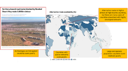
Resilience of domestic transport networks
The resilience of domestic transport networks in the context of food security – a multi-country analysis
Region: International
Description: The flow of food from producer to consumer is vulnerable to shocks at many stages of its journey, but the resilience of this flow to shocks has rarely been studied, especially in comparison to the number of studies that have looked at production shocks. This project contributes to 2021 edition of the FAO flagship publication The State of Food and Agriculture (SOFA), on building resilient food systems for food security and nutrition. It developed and demonstrated a spatial workflow and resilience metrics to analyse transport network structure in the context of national food transport network resilience. /
Partners: University of Twente
Sponsor: FAO
SECBIVIT
Scenarios for providing multiple ecosystem services and biodiversity in viticultural landscapes (SECBIVIT)
Viticultural landscape in Spain (Photo: N. Schwarz).
In agroecosystems, many ecosystem services need to be balanced to achieve sustainable development goals and Aichi biodiversity targets.
Viticulture, the cultivation of grapes, is among the oldest and most profitable forms of agriculture. At the same time, it is one of the most intensive forms of agriculture, negatively affecting biodiversity and the benefits for people ecosystems generate. Climate change, the invasion of alien (pest) species and globalisation all affect viticultural landscapes; in addition to policies at the local, landscape and regional level. Th SECBIVIT project will develop and test model frameworks that integrate various land use and biodiversity scenarios across spatial scales for future management in the viticultural regions of Spain, France, Germany, Austria and Romania. The interdisciplinary research combines qualitative and quantitative approaches, using focus group meetings with key stakeholders, on-farm experiments, system dynamics modelling, agent-based modelling, and big-data analysis.
The project consortium
The SECBIVIT project consortium encompasses partners from Austria (The University of Natural Resources and Life Sciences - BOKU), France (Institut national de la recherche agronomique - INRA), Germany (Julius Kühn Institute - JKI, The University of Koblenz · Landau, and University Göttingen), Romania (University of Agriculture Science and Veterinary Medicine Cluj Napoca), Spain (Consejo Superior de Investigaciones Científicas - CSIC), USA (University of California Davis - UCD), and the Netherlands (University of Twente | Faculty ITC). The project is funded by a joint call of the Belmont Forum and the ERA-NET BiodivERsA network, which aims to strengthen research on climate scenarios for biodiversity and ecosystem services. The team at at University of Twente includes project coordinator Dr. Nina Schwarz (PGM), advisor Dr. Louise Willemen (NRS), and researcher Dr. Yang Chen (PGM).
Objectives
The SECBIVIT project will develop and test different model frameworks to explore alternative forms of grape cultivation to better balance grape production, biodiversity conservation and ecosystem service supply for different climate and policies scenarios in various European viticultural regions. ITC will be in charge of modelling how winegrowers’ decision making on pest management and soil conservation practices in these scenarios will impact biodiversity and ecosystem services.
In detail, the project plans
To develop spatially explicit and locally adapted ABMs based on existing data and stakeholder-driven scenarios integrating winegrowers as agents who take land use decisions in coupled human-natural systems;To develop a model that quantifies multiple biodiversity-related ES and their interactions in viticultural landscapes to identify pareto-optimal land use management strategies under the current socio-economic system;To quantify effects of local and landscape-scale land-use decisions on multiple ES such as pest control, soil fertility, carbon sequestration and nature conservation value to validate the model for analysing trade-offs and synergies between biodiversity and ES under different ecological, economic and market conditions;To implement a software decision-support tool for stakeholders in viticulture that provides information on how to manage their crop to enhance biodiversity and multiple ES in a given context.
Outcome
The results of the project will encompass both re-usable scientific as well as management resources and outcomes fit to be used as basis for further investigation and management. Products such as scientific articles, datasets and software will be provided on Open Source platforms whenever possible.SEBS4Google
Implementation of SEBS on Google Earth Engine
focuses on implementing the SEBS model in Google Earth Engine, enabling efficient global estimation of evapotranspiration and energy fluxes using satellite data. It supports improved water management and agricultural monitoring.
AfriAlliance for Water and Climate
A network of African-European water-related organisations initiated the AfriAlliance to prepare Africa for future climate change challenges by having African and European stakeholders work together in the areas of water innovation, research, policy, and capacity development. The ambitious five year project officially started with the kick-off meeting hosted by UNESCO-IHE in Delft on 2 and 3 March. ITC is one of the partners in the project.
Sixteen consortium partners were present and set the scene for the project’s main objective: to bring African and European stakeholders together to collaborate on water innovation, research, policy, and capacity development, thereby increasing Africa's preparedness to address future climate change vulnerabilities.
The 2-day kick-off meeting gave EU and African AfriAlliance partners the opportunity to meet face-to-face, exchange ideas and to plan the first year of the project in detail. The topics that were discussed ranged from the thematic focus of the AfriAlliance Action Groups, the processes for identifying social innovations needs and innovative solutions, an innovative triple sensor approach to monitoring and forecasting, as well as the first AfriAlliance conference that will be held in Africa in 2017.
Monitoring and forecasting information web service
Within the AfriAlliance project, ITC will lead the development of a Monitoring and Forecasting Information Web Service on Water Resources and Climate challenges across Africa. This service will use an innovative triple sensor approach, bringing together metadata and up-to-date information on satellite observations, in-situ surface monitoring networks and citizen-based water observations in an geospatially interactive and accessible manner. It will support policy makers and executive staff on the work floor in decision making processes at all levels.
Support existing networks
AfriAlliance will support the existing networks in identifying appropriate social innovation and technological solutions for key water and climate change challenges. The project is financed by the European Commission under its Horizon 2020 programme. The commission recently announced the grant together with 17 other new projects in the areas of raw materials, climate action, water and earth observation.
International Partnership
The AfriAlliance project will be coordinated by the Water Education Institute, Unesco-IHE, and will run from 2016 to 2021. African partners include the African network of basin organizations (ANBO), African water association (AFWA),the West African science service center on climate change and adapted land use (WASCAL) and 2iE, an international university focusing on water and environmental studies, located in Ouagadougou (Burkina Faso). Furthermore, the regional SADC based water expertise network Waternet, as well as the WRC (Water Resources Council) and CSIR (Council for Scientific and Industrial Research) from South Africa participate in the network. European partners include the French international office for water, OIEau; the European water technology platform, Wsstp; a specialised foundation on open-source internet and mobile services, AKVO; and non-governmental organisations, Both Ends and WE&AB.
GlobWetland
GlobWetland Africa was an ESA project supporting African countries in monitoring and managing wetlands using satellite Earth observation data. It focused on capacity building, training, and practical applications for environmental management and policy.Innovation on Remote Sensing Education and Learning (IRSEL)
The objective is to develop a Learning Management System for remote sensing education for two Asian countries: China and Thailand. The Asian partners have experience in the discipline, and they are contributing to the content development as full partners. The developed training material supports education at BSc and MSc levels either as part of regular courses or as independent short courses.
The specific objectives are the following:
To ensure researchers and academic staff in RS and geospatial sciences for studies integrated into world-wide sustainability academia (research) community;To strengthen and integrate RS and geospatial science into Multi-Inter-Trans-Cross- Disciplinary sustainability studies and research of Socio-Ecological Systems;To enhance the role of Asian institutions in socio-ecological systems studies and researches for the benefit of the Asian region;To promote internationalisation on the relevant knowledge areas;To enhance international cooperation between EU and Asian universities and research institutions
The LMS hosts 20 newly developed modules on remote sensing. Ten of them are addressing basic techniques; the other ones are addressing advanced application topics. Building the material into the curricula of the four participating universities will, by the time, enhance the practical use of remote sensing on a wide range of applications serving the labour market and society.
The LMS serves the practical applicability of remote sensing data for a wide range of disciplines, including environmental protection, agriculture, forestry, fishery, physical sciences, engineering, transport services and security services. The LMS aims to foster the uptake of remote sensing applications to boost the benefits that space technology brings to society and economy. The project objective is in line with the EU space strategy.
A consortium of eight partners implements IRSEL:
Óbuda University, Hungary (ÓU)University of Natural Resources and Life Science, Austria (BOKU)Jagellonian University, Poland (JU)University of Twente, the Netherlands (ITC)Fujian Normal University, China (FNU)Yunnan Normal University, China (YNNU)Asian Institute of Technology, Thailand (AIT)Khon Kaen University, Thailand (KKU)
ITC participates in many aspects of the project. We develop two application modules:
Module 15: Application of Remote Sensing in Water Management
Module 16: Ocean/Sea and Coastal Monitoring
Furthermore, we implemented the prototype of the LMS on our server, and ITC is the leader of WP7 on “Quality assurance and evaluation”.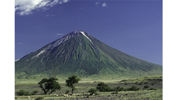
Tanzania Netherlands Energy Project
Tanzanian - Dutch Energy Capacity Building project
In Tanzania there is shortage of well-educated people in the energy sector. Whereas the country has recently discovered large reserves in oil and gas, there is also a huge potential for geothermal energy and other alternative sources of renewable energy. However, the development of the energy sector is slowed down because there is not enough skilled labor available.
The Tanzanian – Dutch Energy Capacity Building project (TDECB) works with training institutions in mainland Tanzania as well as on Zanzibar to train staff, develop education and research programs and invest in equipment. The project is also setting up the Tanzanian Energy Platform, that will enhance the collaboration between education, research and the private sector.
The University of Twente works together with Hanze University of Applied Sciences in Groningen, Delft University of Technology and Utrecht University to support the three Tanzanian institutes of higher education with knowledge development in education. The three Tanzanian institutes are: the University of Dar es Salaam (UDSM), the Dar es Salaam Institute of Technology (DIT) and the Karume Institute of Science and Technology (KIST) in Zanzibar
SEALAN
The East African Land Administration Network (EALAN), an informal and voluntary network of twelve universities in eight countries, aims to improve land administration and land governance, and improve access to land for women and vulnerable groups. The network is receiving support from the SEALAN project. SEALAN wants to strengthen the management of the network, enhancing professionalism of the partners, reviewing existing curricula of the participating universities and developing new curricula; linking the education and training activities to the needs of the labor market, and establishing a shared research agenda among the partners. The strength of the network, which is stimulated by the SEALAN project, lies in the collaboration between the various universities and countries through exchange, cooperation and sharing best practices. The partners are working together on four work packages, dealing with the network and secretariat, short courses and training, education and research.
African partners in the project are: Ardhi University (Tanzania), Bahir Dar University (Ethiopia), University of Woldia (Ethiopia), INES Ruhengeri (Rwanda), University of Rwanda (Rwanda), University of Burundi (Burundi), Makerere University (Uganda), University of Juba (South Sudan), Regional Centre for Mapping of Resources for Development (Kenya), Technical University of Kenya (Kenya), University of Nairobi (Kenya) and Université Évangelique de Bukavu (Democratic Republic of Congo). SEALAN is carried out by a consortium led by ITC and including the Dutch Cadaster, MDF, and the Kenya-bsed Land Development and Governance Institute (LDGI).
ITS4LAND
Geospatial technology innovations for land tenure security in East Africa
In most Western countries land rights are recorded in a land registry. Property has a verifiable owner and a mapped boundary. Usually this kind of information forms the basis for taxation as a form of income for national governments. However, in a lot of countries this is not so obvious and land tenure is not maintained. This causes a lot of disputes, land grabbing, slum formation and miss-use of land resources. The goal of its4land is to develop tools to make the mapping of land rights faster, cheaper, easier and more responsible. They are inspired by the continuum of land rights, fit-for-purpose land administration, and cadastral intelligence. Ultimately this must lead to an end-user oriented land administration system. Therefore, emergent geospatial and Earth observations technologies, including smart sketch maps, Unmanned aerial vehicles (UAVs), automated feature extraction, and Geocloud services are used.
The overriding philosophy of this project is that it transcends single disciplines, country approaches or national boundaries. In this project development means co-designing, adapting, integrating, demonstrating and validating. The project seeks to enable tool combinations that are both end-user and market responsive.
The its4land project is carried out by eight consortium partners from Europe and East Africa combining academia and private sector. African partners are Ethiopia (Bahir Dar University), Kenya (Technical University of Kenya) and Rwanda (INES Ruhengeri; ESRI Rwanda). European partners are the Netherlands (ITC), Germany (University of Muenster; Hansa Luftbild) and Belgium (KU Leuven).
UNDP Tajikistan
The main objective of risk assessment is to assess the vulnerability of communities and infrastructure to natural hazards, determine their degree of exposure to future hazardous events and develop risk reduction recommendations (profiles) to be integrated into development planning processes. The assessment will help to generate the baselines for disaster risk reduction programming in all districts across Tajikistan.
The study consists of a five-phase exercise: (1) Hazard Assessment, (2) Exposure, (3) Vulnerability Assessment (i.e. infrastructural), (4) Damage assessment and (5) Risk profiling. The assessment will give district authorities a wide information on hazards, vulnerabilities and risks.
More specifically, the objectives are:
The District Disaster Risk Assessment Methodology reviewed and if a need be modified.Risk assessment for all the districts of Tajikistan conducted.District Risk Profiles developed.Capacity of the local stakeholders on the process of the risk assessment built.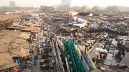
DYNASLUM
Data-driven modelling and decision support for slums
Today, over half of the world's population lives in urban areas, and by the middle of this century, 7 out of 10 people will live in a city. This increased urbanisation has also led to more and more people residing in deprived areas, generally known as slums. The proliferation of slums is a worldwide challenge since people face inadequate shelter, poor sanitation, insecure tenure, insufficient access to health care and in general poor quality of life.
The DYNASLUM project builds high-resolution agent-based models that help describe the growth dynamics of slums in Bangalore, India. Such models create digital representations of slum dynamics that policy- and decision-makers and researchers can use to explore how different policies would influence the growth, emergence or disappearance of slums.
The project is also developing a decision support tool that potentially can assist experts in evaluating or designing policies to improve conditions within slums. This involves developing new computational methods for processing and analysing satellite images, complex-system modelling and new data visualisation techniques for simulation steering.
Through extending an existing decision support prototype and applying it to a new domain of slum policy, the project aims to generalise the current software into a reusable software framework for decision support and disseminate it to other users.
ITC is a collaboration partner in a consortium that is led by the Computational Science Lab of the University of Amsterdam.SPAM – Freeze-Thaw
Modelling Freeze-Thaw Processes with Active and Passive Microwave Observations
Current land surface models cannot adequately capture the onset of freeze-thaw cycles that marks the shift from cold to warm seasons and vice versa. Simulating such freeze-thaw processes is inherently difficult as both heat and mass exchanges need to be fully captured. Better understanding and modeling of such processes becomes imperative because important sources of water and heat are associated with freeze-thaw transitions that are expected to be impacted by climatic changes at high altitude regions. On the other hand, the difference between a frozen and thawed land surface can also be detected from space with active and passive microwave sensors. Indeed, NASA’s Soil Moisture Active Passive (SMAP) mission is the first satellite that will provide soil moisture and information on the freeze-thaw state.
In this project, we aim to advance our knowledge on the presence of soil water under frozen conditions through observing and modeling the physical processes during freeze-thaw cycles using SMAP observations and contribute to Calibration/Validation of the SMAP soil moisture and freeze-thaw state products. We will approach the scientific problem from the a) ground measurement, b) earth observation and c) process modelling perspective. The Tibetan Plateau observatory, where three regional networks are available each holding twenty soil moisture/temperature profiling stations, will be upgraded to enable calibrated liquid moisture measurements under frozen conditions. Additionally, we will develop a fully coupled observation-process model that serves as reference for arriving at an improved process/observation understanding and as test bench for retrieval algorithm development.
SES
Social Inclusion and Energy Management for Informal Urban Settlements
SES helps Ethiopian cities to solve problems related to housing poor urban communities by supporting these communities rather than evicting them from their informal settlements. In offering alternatives for sustainable management and prosperous development of low-income living quarters, SES contributes to preventing further migration by creating livable residential areas forrms the most crucial basis for upward social mobility of the affected poor urban communities.
The objectives include:
improved capacity of HEIs to jointly develop and publish indigenous case studies and course descriptions with stakeholders and other HEIsinterdisciplinary research, which helps to overcome disciplinary silos in addressing issues of urban developmenttransdisciplinary research for the involvement of local communities and public administrationcourses teaching students at Bachelor and Master level to do time-based spatial, socio-economic analysis of current informal settlements, potentials for green energy supply and management tools to guarantee its implementation and applications, governmental housing interventions and their impacts on several case study neighbourhoods in Ethiopian partner HEIs’ respective home cities (Addis Ababa, Mekelle and Gondar).non-university courses teaching professionals about inclusive urban community development * improved capacity of HEIs to interact with public authorities, social communities and NGOsSMARTseeds
Information services for vegetable farmers in Indonesia
Recent changes in climate have caused difficulties for small farmers in making their crop planning and in dealing with pests and diseases related to weather. Accurate and timely information on weather forecast and water availability will help farmers to take better cropping management decisions. The SMARTSeeds project is developing services that provide information on weather, nutrients and fertility status, prices of commodities and recent developments on technology and seeds. The project is not aiming for farmers growing rice, but other produce such as chili, tomato and cucumber. The information helps farmers make better decisions on which crop to grow and when, and when to harvest and bring their produce to market. The information services are also accessible for other actors in the production chain, such as input suppliers, vegetable buyers, farmer groups, financing institutions, NGOs and local government. The information that the SMARTSeeds project produces is distributed by SMS and Smartphone apps, as well as through the extension service of EWINDO.
ITC is a partner in the SMARTSeeds consortium that is led by ICCO and also includes ITB, EastWest Seeds (EWINDO), Akvo, and Nelen & Schuurmans.OWAS1S - Optimising Water Availability with Sentinel-1 Satellites
Many deltas around the world experience increasing pressure on their water systems as a result of changes in supply and demand caused by socio-economic developments as well as climate variability. The grand challenge for regional water managers worldwide is to optimise the amount of water available for all functions according to their respective needs by either retaining or draining water. Indispensable for skilful management of these water systems are reliable up-to-date information on the current situation and models to evaluate the impact of control measures.
The European Sentinel-1 Satellite programme provides a unique opportunity for operational monitoring the water availability from space at unprecedented spatial and temporal resolutions. The project Optimising Water Availability with Sentinel-1 Satellites (OWAS1S) stands for innovative integration of the freely available global Sentinel-1 satellite data and local knowledge on soil physical processes for optimising water management of regional water systems by providing spatial information on the surface soil moisture and value-added products, in particular, crop water availability and field trafficability.
The OWAS1S project accommodates three PhD positions focusing on (1) the exploitation of the freely available Sentinel-1 imagery, (2) the translation of surface soil moisture data to the value-added products, and (3) the optimisation of operational and strategic water management using spatiotemporal information. The close cooperation with users from knowledge institutes, public and private sectors, aims at developing a sustainable application of Sentinel-1 data for operational water management.
Regional soil moisture monitoring networks
Field bearing capacity
Carranza, C., Benninga, H. J., van der Velde, R., & van der Ploeg, M. (2019). Monitoring agricultural field trafficability using Sentinel-1. Agricultural water management, 224, [105698]. https://doi.org/10.1016/j.agwat.2019.105698
FRAME
Agricultural water and land productivity in Africa and the Near East
Achieving food security while using water resources in a sustainable manner will be a major challenge for current and future generations, particularly as we face increased pressures such as economic and demographic growth, and climate change. Agriculture is responsible for 70 percent of all freshwater withdrawals worldwide. That’s why careful monitoring of water productivity in agriculture will allow us to learn how well we are using our water for growing crops and how can we use it better, particularly in water scarce areas.
Improving water productivity often represents the most important avenue for managing water demand in agriculture. Systematic monitoring will help us evaluate water productivity gaps and identify appropriate solutions for closing these gaps.
Water productivity is defined as the quantity or value of output in relation to the quantity of water beneficially consumed to produce this output. Water productivity in agriculture can be expressed as amount of product per unit of water beneficially consumed by the crop.
Project components
Database (FAO / “FRAME” Consortium, led by eLeaf)
The database is publicly accessible, developed with open access data and open source algorithms. It will provide near real time information covering the period between 2009 and 2019.Water and land productivity assessment (FAO / UN-IHE)
On the basis of the database, the second component assesses agricultural land and water productivity, inherent productivity gaps, and possibilities to close these gaps.Water accounting (UN-IHE / FAO)
Through this component, the project assesses, by means of water accounting, the consequences and sustainability of possible increases in water productivity in agriculture.Capacity development and outreach to farmers (IWMI / UN-IHE / FAO / Network)
This component strengthens capacities of stakeholders at different levels to increase water productivity in a sustainable way, building on collaborations with local partners and research institutions.
The WaPOR database
WaPOR is the FAO portal to monitor Water Productivity through Open access of Remotely sensed derived data. It monitors and reports on agriculture water productivity over Africa and the Near East and provides open access to the water productivity database and its thousands of underlying map layers. It allows for direct data queries, time series analyses, area statistics and data download of key variables associated to water and land productivity assessments. ITC is involved in FRAME and WaPOR as Database Quality Control and Validation partner.
WAPOR AT A GLANCE
Remote Sensing can help us monitor water productivity in an objective and cost effective way. As of April 2017, the WaPOR platform offers operational and openly accessible data following a technically sound methodology.
Database structure
Available as of April 2017: Level 1 continental (250 m ground resolution); Next releases: Level 2: 18 countries countries and four river basin (100 m), Level 3: 5 pilot areas in Lebanon, Egypt, Ethiopia, Mali (30 m). Seamless monitoring from April 2009 to date, at 10 days or daily (for precipitation and ET0) interval.
Variables: Water productivity, land productivity, actual and reference evapotranspiration, land cover and use, biomass, precipitation, carbon dioxide uptake, yields, harvest index and crop calendar (Level 2 and 3 only).
Key features: Time series and key statistics, open access to data catalogue with more than 6 000 data layers, direct access through APIs.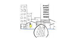
BINUCOM
Building Inclusive Urban Communities
Rapid urbanization is expected to lead to a housing shortage in Indian cities of about 30 million by 2022, which creates appalling conditions for urban poor. A substantial part of the population is already living in informal settlements with lack of tenure, threat of eviction and poor infrastructure. The government of India has addressed this problem by defining a policy of “Housing for All” by 2022 as its goal. This situation creates a huge demand for architects and urban planners, who can deal with the complex challenges of sustainable social housing and the development of inclusive urban communities.
This is an important global issue that is also addressed in several of the Sustainable Development Goals.
The BINUCOM project aims at strengthening the cooperation of Indian universities to jointly develop and publish Open Education Resources, and increase the relevance of architecture and planning by introducing new and multidisciplinary topics such as social inclusion, sustainable housing, participatory mapping and environmental risk assessment. In general, the project will raise the profile of the universities to respond to local needs, improve the employability of their graduates and contribute to better networking between local actors.
Indian partners in the project are the universities of Ahmedabad (CEPT), Coimbatore (KARPAGAM), Mumbai (KRVIA) and Vijayawada (SPAV). The project is implemented by a consortium led by Danube University Krems (Austria), further consisting of Lund University (Sweden) and ITC.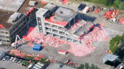
INACHUS
Technological and methodological solutions for integrated wide area situation awareness and survivor localization to support search and rescue teams
INACHUS is an FP7 Integration Project that stands for Technological and methodological solutions for integrated wide area situation awareness and survivor localisation to support search and rescue teams wareness and Survivor Localisation to Support Search and Rescue Teams. The project includes 20 partners, runs for 48 months, and receives an EC budget of approximately 14 million Euro.
Project focus
The project focuses on the development of methodologies to provide increasingly detailed and refined information to urban search and rescue forces following a crisis/ disaster event. To achieve this, several analysis elements will be devised and integrated: this starts with initial and rapid synthetic building performance modelling based on finite element analysis, which aims at a broad assessment of how the building stock in a given area and for a given scenario will behave, providing crisis response organizations with information to ready operations. Results coming from the International Charter, which gets activated after a major event to provide satellite-based damage information, will provide first actual intelligence on damage severity and distribution. If the crisis extent warrants local deployment, the INACHUS system will be mobilized in the disaster area. Starting with a wide-area assessment by a large UAV equipped with lidar and a camera, a more detailed damage assessment will be performed based on 3D reconstruction. This will be coupled with dasymetric mapping to assess likely population distribution at the time of the event, to help prioritize areas for local search and rescue force deployment. In those priority areas a more detailed 3D assessment of building stock will take place, using both terrestrial lidar and a light-weight multicopter UAV. A substantial part of this phase will focus on semantic analysis of the 3D data, including model matching with libraries of building types and internal structure, to create hypotheses about the location and size of cavities where survivors may be found. At this point a variety of sensors will be deployed, including an IMSI catcher to detect mobile phones, electromagnetic and chemical sensors to detect the presence of humans, and a snake robot equipped with sensors to penetrate the rubble.
Our contribution
ITC’s part of the project amounts to 65 person months, which are mainly linked to a full-time AIO. Then research work to be done by ITC focuses on wide-area damage assessment based on nested integration of multi-source data, including the population mapping for search and rescue area prioritization, the photogrammetric processing and analysis of airborne UAV data for detailed building damage description, and the 3D data fusion and exploitation, including semantic analysis, model matching and machine learning (including deep learning with CNN). In addition ITC has the lead in the development of training materials, which alone accounts for 10 person months, and mirrors the sophisticated of the system to be developed.
DownloadsFLORES
Exploring fluorescence and pigment reflectance as methods to estimate photosynthesis with remote sensors
This project assesses the added value of two new indicators of photosynthesis observed from space: solar-induced chlorophyll fluorescence (SIF) and the photochemical reflectance index (PRI). Chlorophyll fluorescence, which has been used to estimate photosynthetic activity in plants for decades, has recently for the first time been observed by satellites originally designed for mapping atmospheric chemistry. PRI can provide complementary information on the light-use efficiency of the plant. The interpretation of SIF and PRI as measured from space is complicated by the effects of limited spectral sampling, scaling from leaf to satellite pixel, atmospheric effects and viewing and illumination geometry. We investigate this problem with our model SCOPE (Soil-Canopy-Observation of Photosynthesis and the Energy balance). We first incorporate the optical effects of changes in the xanthophylls, the pigments that control light use efficiency and affect both SIF and PRI, in SCOPE. Our approach is validated by reproducing SIF and PRI for existing data sets: multi-directional canopy-level field and airborne observations. We perform sensitivity analyses in order to quantify the effects of observation and illumination geometry and weather-induced leaf-level variations in SIF and PRI. Finally, we will simulate PRI and fluorescence as observed by existing satellite sensors (GOSAT, MERIS and MODIS) in order to study the relationships between SIF, PRI and gross carbon fluxes for different biomes. Our results will improve global estimates of carbon fluxes by direct measurements of photosynthetic activity from space.Monitoring for Environment and Security in Africa
MESA was an African programme that used satellite Earth observation data to monitor environmental and security issues such as drought, agriculture, and water management. It strongly focused on capacity building and supporting decision-makers.
CARE: Empowering Climate Resilience
By focusing on urban resilience, CARE addresses one of the most urgent topics in EU and Latin America (LA). Most LA countries are dealing with climate risk management issues, but they lack a holistic and common approach to resilience. International cooperation seems then the best-fit environment where to develop joint learning tools, go in depth on peculiar research and deliver support to policy makers. An urban resilience framework calls for a process that brings together diverse departments and sectors to identify appropriate measures, responses and recovery. It needs transversal competences, e-skills, creativity and flexibility.
CARE aims to challenge those issues by promoting HEI staff’s and students’ interdisciplinary skills by developing innovative educational approaches to planning. Furthermore, it aims to bring the challenge within the core of urban municipalities by directly and indirectly training professionals and officers to shape resilient policies. To attain this goals, CARE proposes an alternation of desk activities and workshops aimed at the collective production, development, sharing, testing and dissemination of Open Educational Resources (OERs), based on the use of collaborative Conceptual Maps. Being publicly available on the CARE e-learning platform in English and Spanish, they are expected to empower programme courses in HEIs (CARE Cmaps) and provide targeted training for professionals, public officers, policy makers (Open Training Modules).
CARE outputs will challenge the complex and interconnecting issues related to urban resilience. It will operate to transfer resilience conceptual issues into operational capabilities in local government, civil society and professional communities. Finally CARE aims at establishing a network among LA, Europe and outside, to improve their educational capacities on urban resilience, as well as to transfer CARE results and findings to an operational policy perspective at different territorial levels.Capacity Building for Integrated Water Resources Management in South Africa
This project (2010–2018) was a collaborative initiative between the University of Twente (ITC), Nuffic, and the Cape Peninsula University of Technology (CPUT). It aimed to strengthen the capacity of South African water professionals in Integrated Water Resources Management (IWRM). Within ITC, the project is categorised under Resource Security. Led technically by Dr. Ben Maathuis, the program focused on training staff to use geospatial tools and satellite data for more sustainable, locally-oriented water resource management.GIACIS
Geodata for Innovative Agricultural Credit Insurance Schemes
The majority of farmers in Ethiopia have less than 0.5 ha of land. These subsistence farmers are very vulnerable to climate-based risks such as drought. Trying to avoid unnecessary risks they are not inclined to invest and adopt recommended management changes, although a basic insurance would go a long way to get them out of this poverty trap. The GIACIS project has developed the required insurance instrument. It reduces the impact of drought related shocks in income of smallholder farmers, especially when they made extra investments using credit or own capital. ITC developed the method, algorithms and tools to interpret satellite imagery to monitor the status of the green vegetation. Every ten days this information is used to calculate the severity of drought by crop production zone and to determine the indemnity payments due. The target is that farmers are automatically insured against drought, indirectly when using credit to buy agricultural inputs, or directly when purchasing those inputs. Implementation relies on low-cost branchless banking technology using apps for mobile devices, and on scalable financial inclusion that can reach the majority of rural areas. GIACIS is a public-private partnership between ITC, Kifiya Financial Technology, the Agricultural Transformation Agency (ATA) and the National Meteorology Agency (NMA) of Ethiopia.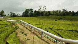
GEOCAP
Geothermal capacity building programme Indonesia-Netherlands
The GEOCAP project is a public-private partnership in which Indonesian and Dutch knowledge institutions, universities and companies are working together on issues related to geothermal energy The Government of Indonesia has high ambitions for shifting to new and renewable energy sources, and changing the energy mix in the country. This required more personnel at academic as well as operator level than the current system could produce, and created a gap that needed to be filled. The GEOCAP consortium is working hard to achieve this.
The objective of the programme is to increase the capacity of Indonesia’s ministries, local government agencies, public and private companies and knowledge institutions in developing, exploring and utilizing geothermal energy sources, and to assess and monitor its impact on the economy and the environment. This is done through a wide range of work packages dealing with education and training, research, a subsurface database program, development of direct use applications, and a program aiming at innovative activities for the future. Education and training is developed in cooperation with three Indonesian universities, but is also aiming for technical and operational training within the national qualification framework.
As part of this project ITC is working together with ten partners, including geothermal energy companies from Indonesia and the Netherlands, Delft University of Technology (TU Delft), Utrecht University, the Netherlands Organization for Applied Scientific Research (TNO), and three Indonesian universities (i.e. ITB, UGM and UI).MaMaSe
Decades of encroachment and deforestation have disturbed the natural regulatory mechanisms in the watershed of the Mara river. This has negative impacts on farmers, tea estates, cattle and wildlife and the erratic availability of water is becoming a serious limitation for development in the area.
To realize improved water safety and security across the entire Mara River Basin, the MaMaSe Initiative is focused on five solutions.
A water management strategy supported by local authorities and stakeholdersConservation of existing forests and restoration of depleted forestsSustainable management of range lands outside the Masai Mara ReserveCreation of sustainable modes of financeSupport for activities that improve water quality
These solutions are designed to enable the people of the MRB to achieve self-reliance and adapt to changing socioeconomic and environmental conditions in the future. They focus on improved water management in the main economic activities of the basin: agriculture, cattle ranching, and wildlife-based tourism.
The Initiative, which is financially supported by the Netherlands Embassy in Nairobi, consists of a broad-based, basin-scale public private partnership which is led by UNESCO-IHE. It includes international and Kenyan government agencies, civil society, private sector, NGOs, and knowledge institutions.
Result
Watch this video to see our results.SIGMA
Stimulating Innovation for Global Monitoring of Agriculture
SIGMA or “Stimulating Innovation for Global Monitoring of Agriculture” is part of the European (EU FP7) contribution to GEOGLAM and addresses some of the key challenges within global agricultural food production. It intends to reinforce the G20 Global Agricultural Monitoring initiative on improving sustainable data for worldwide food security and commodity market transparency.
SIGMA will investigate and develop methods that make use of operational remote sensing data from the European Copernicus Global Land Services. Particular attention is on satellite data for agriculture monitoring that allow contributing to a global agricultural monitoring "system of systems". In particular, methods will be developed for various agro-ecological systems in the world, with sites in Europe, Africa, China, Argentina, Russia, Ukraine and USA. Copernicus land cover, hydrology and vegetation data products will be part of the basic datasets that will be used to develop agricultural monitoring products. Given the global nature of the Copernicus products, upscaling to regional and global level will also be investigated.
The experiences and feedback from SIGMA will potentially lead to an improvement of the algorithms and applicability of the Copernicus Global Land parameters. ITC is involved in the satellite hydrology component of the project, generating geo-information on evapotranspiration and water use by agriculture.
The ITC Departments of Water and Natural Resources will together with FAO, also ensure the capacity development and dissemination component of the project, through e-learning and continental training workshops. SIGMA is coordinated by VITO together with a global partner consortium i.e. Alterra (Netherlands), RADI (China), FAO (UN), CIRAD (France), IIASA (Austria), IKI (Russia), SRI (Ukraine), MSMC (China), DEIMOS (Spain), Sarmap (Switzerland) , JRC (EC), UTwente-ITC (Netherlands), UCL (Belgium), EFTAS (Germany), GeoVille (Austria), GeoSAS (Ethiopia), RCMRD (Kenya), INTA (Argentina), GISAT (Czech Republic), AGRHYMET (Niger) and SARVISION (NL). SIGMA runs from Nov, 2013 up to March 2017.TIGER Capacity Building Facility – Phase 2 (extended)
The extended second phase of TIGER continued to strengthen African institutions by providing training and support in the use of satellite Earth observation data for water resource management and environmental applications.
STARS
Agricultural improvement in emerging economies
STARS is a research project which is looking for ways to use remote sensing technology to improve agricultural practices in Sub-Saharan Africa and South Asia. Supported by the Bill & Melinda Gates Foundation, the project hopes to significantly advance the livelihoods of smallholder farmers in some of the world’s poorest countries.
Background - the Challenge
High-income countries have seen recent improvements in their agricultural management systems through modern remote sensing technology, such as satellites, aircraft and the information they collect. Out of the vast amount of data collected, advice can be provided to farmers on the ground to help inform their decisions about farming methods. This leads to better crop yields, higher quality produce and possibly more sustainable practices for the farming communities. This data can also inform higher-level decisions to manage national food supply needs more effectively.
Out of the vast amount of data collected by remote sensing technology, advice can be provided to farmers on the ground to help inform their decisions about farming methods.
The significant spatial and technical challenges present in Sub-Saharan Africa and Southern Asia, have prevented the use of remote sensing technology in many areas. For example, smallholder farmers, who produce two thirds of the world’s food, often have small plots with undefined boundaries, they often grow multiple crops on the same plot and there is significant variety in the farm practices they use. These conditions make it difficult to distinguish farming practices from the skies and therefore, to capture and collate accurate and potentially actionable information, brought to farmer groups, agribusiness and public agencies.
Challenges such as unproductive soil, plant diseases, pests and drought, mean that many farmers struggle to produce crops consistently and sustainably year-by-year. At a national level, these challenges can also present difficulties in understanding the condition of crops and pastures, seasonal outlooks, access to markets and likely production levels. Decisions such as whether additional food needs to be imported to supplement that season’s harvest, have been misjudged in the past due to a lack of information. There have been examples where produce was imported erroneously before what turned out to be a bumper crop, leading to an oversupply of food and financial difficulties for smallholder farmers as food prices plummeted.SEMA
The SEMA project is based on what is called a human sensor web: a combination of social media, mobile networks and spatial applications that will give ordinary citizens the opportunity to report on the quality and functioning of public services. In the SEMA project the application focused on public water services and health care and allows ordinary citizens to directly influence public service delivery.
The human sensor web is a communication network of spatial and other web-based applications, google maps, new media and normal people with their mobile phones (the “human sensors”). The applications provide access to public service locations, such as water boards and healthcare. If the level of service is below standard, ordinary citizens can issue a complaint using their mobile phone. The caller goes through a digital menu, after which the application displays the complaint as an icon on the map, at the place where the public service is located. It is now visible to everyone when a supplier is in default. The icon remains visible until the problem has been solved.
The project focused on a number of research themes
A number of hackathons were organized to let people work out workable solutions to a number of challenges they had to face. Outcomes were shared and formalized during workshops. Part of the project work concentrated on 4 research themes to integrate knowledge from different disciplines relating to water and sanitation and public health, and then specifically on the interaction between technical disciplines and applications. The project is one of the activities of ITC that contribute to the Sustainable Development Goals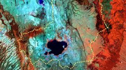
Integrated Water Resources Action Plan (IWRAP)
The Lake Naivasha basin is diverse both in terms of ecosystems and economic activities, all of which depend on having enough water of good quality. Over the last 30 years the basin has undergone several economic transformations that threaten both water quality and quantity. The basin is relatively small and ranges from highlands in the north east and west, to semi-arid rangelands in the south and south east. It is home to three National Parks (Aberdares, Longonot and Hell’s Gate), as well as at least six privately-owned wildlife sanctuaries, and it is the heart of Kenya’s horticulture industry. The lake’s natural beauty, rich biodiversity and mild climate alone attracts up to 1.8 million visitors annually.
The IWRAP programme brings together all stakeholders in the area and a consortium of Dutch and Kenyan organizations to develop an integrated water resources management plan that serves the needs and interests for long-term sustainable developments of all stakeholders.
The specific task of ITC is to Increase knowledge and technical capacity for quantitative water resource management and monitoring in Lake Naivasha Basin. Basically, this means that capacity will be built up at the Kenyan organizations that manage the lake to constantly monitor the quantity and quality of the water resources in the basin. In addition, various models for groundwater and surface water will be developed and staff will be trained to maintain and use these models for scenario analysis and forecasting.
The project has developed a web-based platform that makes all data and information generated publicly accessible through internet.

Menu