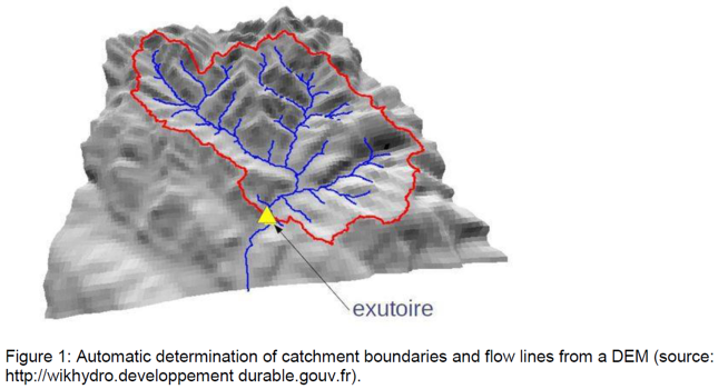
Geomorphology plays a major role in the concentration and circulation of water within a catchment area through the organisation of the contributing zones, the relationship between the water table and the rivers, and the hydrographic network. Digital Elevation Models (DEM) are now used to describe these organisations and to estimate hydrological behaviour at any point in space. Geomorphologically based hydrological modelling thus offers robust perspectives, including for ungauged catchments (de Lavenne, 2013).
The modelling tools developed at INRAE Antony (GR4H type) are often used operationally to predict river flow based on meteorological inputs: flood forecasting, low flow forecasting, analysis of the effects of climate change, etc. However, they make little use of this available geomorphological information. This internship will therefore focus on describing the geomorphology of catchments and integrating this description into rainfall runoff modelling. Efforts will focus mainly on the transfer function of the GR4H model, propagating the flow within the river network to the outlet of the catchment. In addition to improving the performance of the model, this internship will aim to better distinguish the different flow paths within the model (notably the flow paths through the hillslopes from the flow paths within the river network) and the associated travel times. Both of these insights are a first step towards a water quality modelling perspective (Hrachowitz et al., 2016).
Objectives
- Refine the GR4H transfer function through the use of a geomorphologically based unit hydrograph(HU) rather than the current theoretical HU. This will be constructed by processing a DEM. Differentgeomorphologically based HU constructions will be considered.
- Update the model structure to describe more explicitly the transfer within the river network(described by the HU) and the contribution of the slopes (described by the GR4H reservoirs).
- Take into account the spatial variability of rainfall in the GR4H model. By geomorphologicalanalysis and under certain hypotheses, the catchment can be divided into isochrones (zones of thesame temporal distance to the outlet). By overlaying a rainfall map on these isochrones, the spatial variability of rainfall can be taken into account (Cudennec et al., 2005).
Methodology
- Literature review, particularly on geomorphological modelling.
- Implementing GR4H model using the R package airGR and setting up the model on a limited number of test basins (2 to 3) and a few rainfall runoff events (10 per basin).
- Construction of different geomorphologically based HUs and implementation of this HU in GR4H (objectives 1 and 2). Analysis and comparison of performance on these test basins.
- Spatial analysis of rainfall and development of a computer code to distribute the rainfall information in the different isochrones of the basin (objective 3).
- Writing the thesis report
References
- Cudennec, C. et al. (2005). Accounting for sparsely observed rainfall space time variability in a rainfall runoff model of a semiarid Tunisian basin. Hydrological Sciences Journal, 50(4). doi: 10.1623/hysj.2005.50.4.617.
- Hrachowitz, M. et al. (2016). Transit times the link between hydrology and water quality at the catchment scale. Wiley Interdisciplinary Reviews: Water, 3(5), 629 657. doi: 10.1002/wat2.1155.
- de Lavenne A. (2013). Modélisation hydrologique à base géomorphologique de bassins versants non jaugés par régionalisation et transposition d’hydrogramme. Thèse Agrocampus Ouest Rennes. (tel 02810356).