Project | Spatio-temporal inequalities in mobility and accessibility in Brazil – analysis using mobile phone data |
Timeline | 2021-2025 |
Supervisor | Prof. dr. Karst Geurs, University of Twente (k.t.geurs@utwente.nl) |
PhDstudent |
The rapid popularisation of mobile technology has made it possible to collect a large amount of big data. This has led to a new perspective on the study of human mobility since a large number of geolocated datasets related to human movement has surged in recent years (e.g. mobile phone records and online social network data). This work will use the Call Detail Records, which are part of the data generated by the phone companies, for billing users and record, among other information, identifiers of users and antennas used by them, which allows identifying the movement of users in the covered area along time. Those identifiers do not change through time, allowing to collect information on multiple days. These new mobility data have two advantages when compared to traditional ones: they cover a very large sample of the population and are usually collected continuously, allowing studies on the population’s mobility spatial patterns across time.
 Mílton Jung
The main research question in this project is: What are the advantages (and disadvantages) of using mobile phone data to measure inequalities in spatial and temporal variations in accessibility in São Paulo, Brazil? Transport studies based on big data have been gaining relevance, as well as the use of the concept of accessibility to assess inequality issues. However, to the best of our knowledge, these two fronts are not yet related in the literature, as proposed in this study. A space-time geographical approach is suited to examine differences in travel-activity and accessibility patterns between individuals, but requires detailed data on travel-activity patterns which are typically collected using surveys for a small portion of the population and/or small geographic area. This project intends to tackle this limitation by developing a space-time geographical approach to capture spatial and urban mobility inequalities based on mobile phone data.
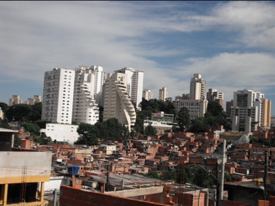
The study utilises two mobile phone data sets of São Paulo, Brazil: (a) CDR of people that live in or close to low-income (favela) areas, and (b) CDR data covering the whole municipality of São Paulo, with a lower resolution.
This PhD project is a collaboration between the University of São Paulo and the Department of Civil Engineering of the University of Twente.