UT FieldLab integrates education, research and innovation into urban and NATURAL DOMAINS
UT FieldLab provides a unique semi-controlled outdoor setting at the University of Twente campus. It functions as a research, innovation and education lab to enable experimentation and support the development of new skills for students, researchers and professionals. Local communities and industrial partners will help connect this lab to the larger global ecosystems in which the UT collaborates.
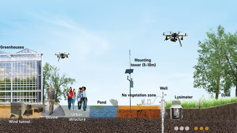
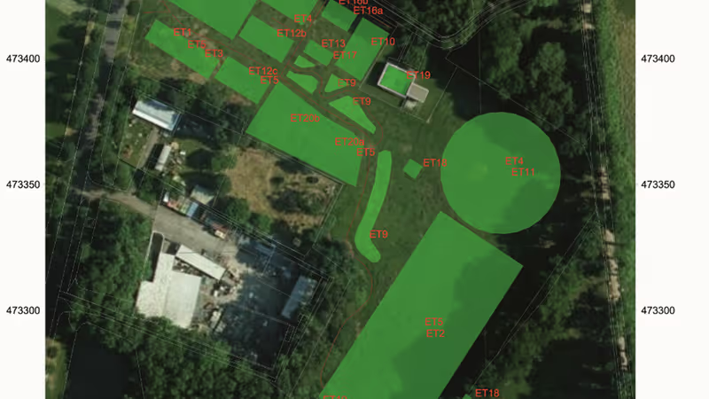
UT FieldLab hosts more than fifteen transdisciplinary experimental sections, both above and below ground. Scientific and societal challenges are at the heart of the lab, and will involve scientists from multiple faculties, clustered around different types of experiments and expertise.
Themes
- Earth Structures and Dynamics
Subsurface observatory for soil mechanics and geophysical experiments
Due to extreme droughts and rain, soils are subjected to severe thermo-hydro-mechanical loads. Subsurface observations at UT FieldLab aim at
- study the interaction between soil characteristics, underground water flow and root growth under natural hydraulic cycles, using 4D seismic imaging techniques;
- deepening understanding of wave propagation in soils and improve monitoring capabilities.
- Water Cycle and Climate
Climate tower
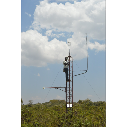
At the Climate Tower, we study the exchange of water and heat at the land-atmosphere interface through measurements of radiative and turbulent fluxes, evapotranspiration, soil moisture and groundwater. This will help us to understand the effect of weather on hydrometeorological processes and how these develop during wet extremes and droughts in the face of climate change.
Land2Sea Lab
The Land2Sea Lab looks into interactions at the land-sea-air interfaces and has three facilities: an open-end wind tunnel in which sand and vegetated soil beds can be placed; an aquatic-vegetation greenhouse with tide simulator; and an outdoor water basin with variable depth and wave paddle. The lab offers controlled environments to study processes that govern dynamics of beach-dune systems, intertidal marshlands and shallow coastal waters.
- Urban Spaces and Infrastructures
Localisation and positioning
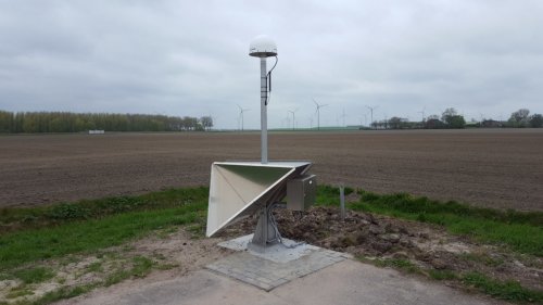
An IGRS (integrated geodetic reference station), as a ‘satellite totem’, includes double back-flip corner reflectors and one GNSS receiver. With this ‘satellite totem’, we aim at offering a ground reference for both radar and GPS missions.
Utility mapping siteMapping utilities becomes ever more essential for the (re)construction of urban space. While sites become more crowded with new and ageing infrastructures, contractors and engineers seek more ways to explore the location and status of existing buried assets. At UT FieldLab, we use the built ground truth site containing various soil types, cables, and pipeline layouts to test geophysical instruments, and develop automated methods for collecting and interpreting survey data. The site is pivotal in the national ambition to develop and train 'underground surveyors' for the utility sector.
Wireless ground communication
The Wireless Underground Communication Lab (WUCLab) enables monitoring the underground world by performing research on reliable and efficient wireless sensing and communication. This will enable real-time monitoring of the soil for e.g. agricultural applications. The lab consists of a 3D underground network with configurable wireless sensors. Networking operations can be controlled via a web-based dashboard.
Greening Infrastructure
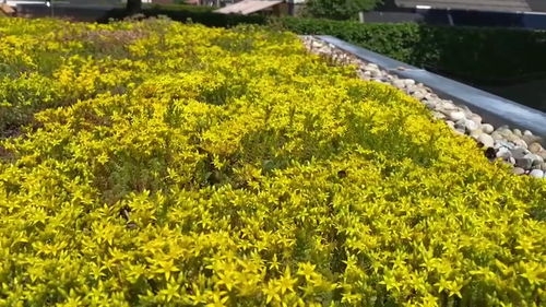
We will be placing temperature loggers at different sites within the UT FieldLab to inspect temperature variations over different land surface specifications. We are installing various green roofs and green walls, in order to quantify the impacts on energy and water, from a life cycle perspective.
- Ecosystems and Food security
Biodiversity monitoring
Within UT FieldLab, we will create, calibrate, and test new technological solutions for biodiversity monitoring. Imagine students designing the next generation of intelligent wildlife cameras, bird sound classifiers, and radar systems to detect, identify, and track airborne insects, in experiments closely related to the ARISE project, in which we are building an infrastructure to identify and monitor all multicellular species in the Netherlands.
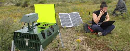
Photo: Image at the courtesy of W. Daniel KisslingVegetation monitoring
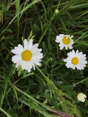
The vegetation monitoring consists of two parts: one field with plots of different vegetation types, from crops to (semi)natural vegetation, under different management regimes and growing conditions to be sensed by the various (handheld) sensors. A second field with only one or two crops is used for sensor calibration for time-series using semi-continuous observation by cameras from a tower.
Léon olde Scholtenhuis:
“The Living Innovation Lab is a unique facility where we can take years of collaborative research between faculties to the next level. In addition, it offers unique opportunities for education and because of the type of projects we do, strongly linked to current issues in society, it is also a great place to give the public an insight into what UT is doing in a lot of areas.”
Wim Timmermans:
“In addition to providing insights to the general public, LILa offers researchers the opportunity to work on developing new methods and techniques in a transdisciplinary setting. The design of this specific setting also inspires toward original and surprising scientific insights.”
Mark van der Meijde:
“The Living Innovation Lab is a unique facility where we can take years of collaborative research between faculties to the next level. In addition, it offers unique opportunities for education and because of the type of projects we do, strongly linked to current issues in society, it is also a great place to give the public an insight into what UT is doing in a lot of areas.”
