Satellites are our eyes in space. They map soil moisture, melting polar ice, and cloud formations. They show us where drought strikes, forests disappear, and ecosystems transform. But is that all they can reveal? According to Vermunt, the answer is no. He is investigating how hidden signals in satellite data can unlock valuable insights about tree water content.
Scientists like Vermunt are uncovering these hidden messages, extracting untapped potential from existing satellite data. What can a microwave signal reveal about the water content in a forest? By creatively repurposing satellite data, Vermunt is exploring new possibilities. But this is far from simple. For example, a GPS signal can weaken as it passes through water in tree canopies. To determine whether this attenuation can help measure drought stress, water content must be measured in many more locations on Earth.
From cubic centimetres to entire forests
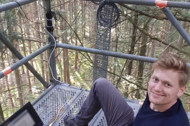
“To make satellites suitable for measuring drought, we need to understand how water in trees influences the readings,” Vermunt explains. To do this, he employs a wide range of sensors in the Speulderbos forest, each measuring water content uniquely. Some sensors focus on cubic centimetres, while others capture data on an entire forest scale. “This approach gives us a complete picture of the forest,” he says. This is the first time such a diverse array of sensors has been combined to create such a detailed view of forest water dynamics.
"With this improved data, we can improve the research on the impacts of climate change on forests globally, thus contributing to policies for more resilient forests," said Vermunt. The collected data will be used to validate and calibrate mathematical models that use satellite measurements, making them more accurate. In the future, improved models will allow scientists to study the effects of drought on forests on a global scale. This research is not only crucial for the Veluwe but also for forests worldwide that are increasingly facing longer and more intense droughts.
About the Research
Dr Paul Vermunt, a postdoctoral researcher at the University of Twente, specialises in measuring vegetation and soil moisture using microwave technology. His work takes place in the Speulderbos forest, where he uses a 46-meter-high tower to test sensors and gather data. This data will form the foundation for a new generation of satellite applications. This project – developed largely by Vermunt himself – was inspired by his concerns about the impact of dry summers on forests. It was made possible by a research grant from ESA.


