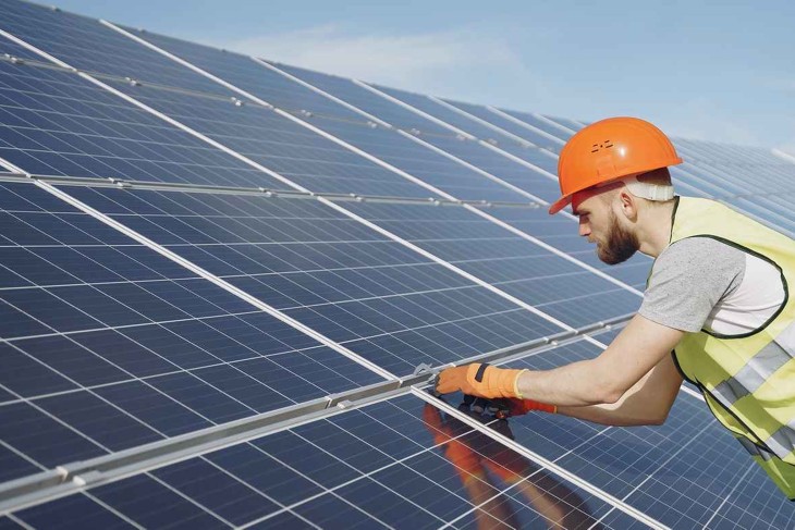

Herenboeren Usseler Es in Enschede is run by a community of 250 households. They work together to grow food sustainably and organically, without chemical fertilisers and pesticides. Unlike traditional farms, where decisions are often based on best practices, they also use tools such as drones, satellite imagery, and sensors. These tools help them to more precisely measure the impact of weather conditions and monitor soil and crop health.
Dr. Iris van Duren, assistant professor at the University of Twente, focuses on remote sensing and spatial analysis for natural resource management. She explains: “The farmers were struggling with questions like, ‘Which crops thrive in which part of the farm? How long does the soil stay moist enough for growth? When should we water the crops?’ These are common issues in crop farming, so we applied remote sensing technologies from the University of Twente to help them farm more sustainably.”
Data-driven agriculture
Soil sensors are placed across the farm to measure moisture levels alongside groundwater tubes that track underground water levels. This helps the community ensure that crops receive the right amount of water. Additionally, they use drones with thermal and multispectral cameras to assess plant health and water usage. For example, the thermal cameras indicate how well-watered the plants are by measuring the temperature of the leaves. "When plants have enough water, their leaves can be up to 10 degrees cooler than the air around them. Measuring that temperature helps us to use water more efficiently,” says Dr. Florian Ellsäßer, also an assistant professor at the University of Twente. He specialises in agricultural and forestry landscape monitoring and biophysical and ecological process modelling.
A weather station tracks meteorological parameters such as rainfall and wind speed. This information helps the community adjust their practices to maintain crop health. Besides keeping the crops as healthy as possible, another priority for the researchers is biodiversity. There is a dedicated team that monitors the birds and insects to assess the overall impact of the farming practices.
As the community at Herenboeren Usseler Es works hard to build a sustainable farm, they not only deal with scientific challenges but also unexpected practical problems. “We installed cameras that captured plant water stress and greenness to monitor plant health, but, unfortunately, they were stolen. This is also one of the challenges we face: what do you do when the equipment gets stolen?”
Geospatial technologies
All the data is stored on a server and shared through a dashboard designed by and accessible to the entire community. Ellsäßer explains: “The dashboard is the most exciting part because it displays the data in almost real-time. Earlier this year, we held a workshop with the community to discuss what information they wanted to see. For example, if they want to water during a dry summer, the data on the dashboard can now provide them with information on when to turn on the pumps."
The team has also established a JECAM site, part of a global initiative that shares agricultural insights across 160 sites, such as Argentina, Kenya, and China. “Whether fighting pests or improving water usage, it allows an exchange of agricultural practices and monitoring strategies across different regions and climates,” Ellsäßer says.
Wide scope
Their team aims to support the global farming community by providing access to reliable and affordable open-source information. “With a server that costs as little as 50 euros and a few weekends for setup, any farmer with basic computer skills can build and implement a similar system for their land," Ellsäßer says. Low-cost, open-source weather stations and soil moisture sensors can easily integrate with open-source software to collect and analyse data. Although this approach is currently applied on a small scale for local food production, it has the potential to address bigger agricultural challenges globally.
With seed funding from UT's Climate Centre, the researchers are following a Geo-Techno-Social approach to develop a sustainable water management concept to deal with a changing climate.