The aim of the project is to understand the development of the coastal system after such a large scale natural intervention due to the earthquake and the tsunami on 26 December 2004. The study object is the Banda Aceh coast, Sumatra, Republic of Indonesia, which is the worst hit area by the catastrophe. The focus of our research is investigation on the coast response due to this sudden change and the morphological development after the earthquake and the tsunami. The overall research question to be answered in the end is at which time scale this morphological development will lead to a new equilibrium, and what will be the new equilibrium. This knowledge should contribute to improved management of the coastal zone; e.g. as the important information of possible coastal safety measures.
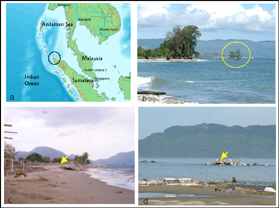
Figure 1. Banda Aceh, located on the tip of Sumatra Island, Indonesia (a). Indication of land subsidence by mangrove trees stood on the sea with submerged trunks (b). A coastal structure at Ulee Lheue Beach (North coast) before and after the tsunami (c&d, respectively).